Articles in the Applications Category

Archaeology reflects the amazing diversity of human life across the globe (Neto, 2000). Archaeological investigations are considered as a principal source of knowledge of prehistoric, ancient, and extinct cultures. In order to reconstruct history, archaeologists rely on all the unearthed evidence, such as man-made objects, which can be as small as tools and ornaments or as large as architectural residues (Xia, 2006). Thus, it is important to explore archaeological contrivance and record them in a systematic way.

I was given the title of this article “How Japan is managing the disaster of this magnitude?” by the Coordinates magazine but I dare to say that Japan is not yet managing the disaster but suffering from the hardships. Though all Japanese people are in mourning the sorrow, I feel it should be my duty as an old scholar to report on the biggest earthquake and Tsunami to the rest of the world. I hope that my report would be useful to prevent the similar misery.

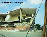
An earthquake of magnitude 9.0 occurred on 11th of March at 14:46 in the east of Japan, causing a tsunami which hit the east coast, and made extensive damages in five prefectures: Aomori, Iwate, Miyagi, Fukushima and Ibaraki, and has made direct and indirect impacts to the other nearby provinces including Saitama, Chiba, Tokyo and Kanagawa prefectures. As of March 21, the confirmed number of death is 8,450 with reported missing 12,931. Thus, the total casualty may be over more than 21,000 people, and therefore making it as the worst disaster Japan has experienced after the World War II.

Recommendations of the National Commission on Urbanization (NCU), set up in 1985, covered the aspects of emergence of nodal points; special regional characteristics of urban growth; spatial eco-tones of urbanization; spatial distribution of wheat and rice productivity and industrial employment; and spatial planning of settlements . Besides other analysis, it studied the spatial distribution of cities and urban agglomerations in 1971 and 1981 .

Suresh V Kibe
The Ministry of Civil Aviation, Government of India has the sovereign authority to modernize the Indian Airspace. Rapid strides have been made by the Ministry of Civil Aviation in implementing many elements of the Global Air Navigation Plan recommended by the International Civil Aviation Organisation (ICAO) for Communications, Navigation, Surveillance (CNS)/Air Traffic Management (ATM) systems. India is a founding member of ICAO and is a regional member of the ICAO Asia Pacific Air Navigation Planning …

After the euphoria over the successful Chile mine rescue it is time to analyze the incident and ponder on the lessons learned.
Mines and accidents have been intertwined since time immemorial. But the Chile mining accident has become a watershed. Not because of the accident itself – this was no different from the many that have …

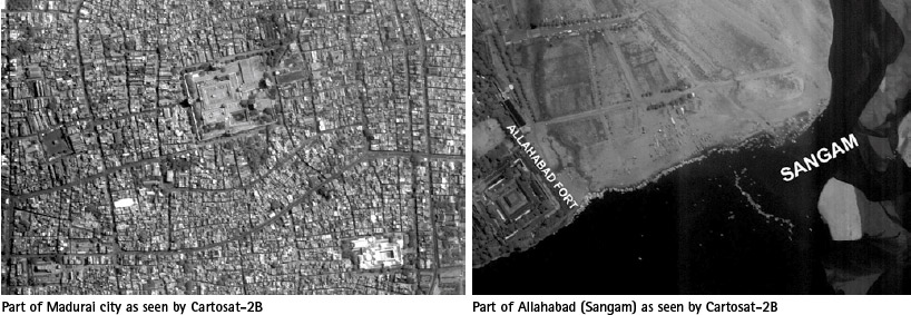
Latest Indian RS Satellite Cartosat-2B and a Dream’ of students
India’s Polar Satellite Launch Vehicle (PSLV-C15) successfully launched CARTOSAT-2B from Satish Dhawan Space Centre (SDSC) SHAR, Sriharikota on 12 July 2010.
In addition to CARTOSAT-2B; PSLV-C15 carried four auxiliary satellites namely STUDSAT a pico-satellite weighing less than 1 kg, built jointly by students from a consortium …

The need – environment of an Urban Information System has undergone a sea change over the last few years. Couple of years back the requirements of information system was designed and projected primarily from the planners community. They were satisfied if the physical information was supplied on a scale of 1:5000/1:10000…

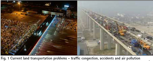
During the last half century, countries all over the world went through a remarkable economic growth, which resulted in higher income levels and changes in people’s way of living. In particular, transportation industry has undergone a dramatic change. The number of privately owned cars has explosively increased to facilitate individuals’ travel. Volume of goods transportation also rose sharply due to expanding global trade and online commerce…

During a disaster, situational awareness can mean the difference between life and death. Satellites provide reliable and rapid communication, observation and positioning tools, especially when crucial on-the-ground infrastructure is damaged. Risk management activities also benefit greatly from space-based data…


 (5.00 out of 5)