Articles in the Mycoordinates Category

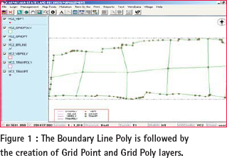
LAND forms important part of development activity. Land revenue is one of the sources of income for state governments. It may come from land holdings by private individuals, real estate transactions or other natural resources being tapped by various sections of the society. Hence, creation of a Land Information Management System involves
We published a circular by Central Board of Excise and Customs, Government of India that came out in April (Coordinates, May 2007).
The circular classifies high technology featured mobile phone including GPS as a secondary feature as mobile phone.
That implies four per cent custom duty rather than 34 per cent as applicable to …

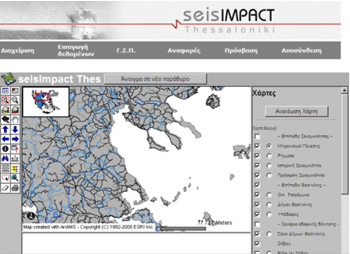
Greece has suffered many times from big earthquakes that caused human victims as well as big damage to public and private infrastructure. However, the 1978 earthquake in Thessaloniki (Mw = 6.5) motivated the beginning of a more systematic confrontation of the impact of such phenomena. This happened because it was the first time that a powerful earthquake affected a big modern city of roughly one million of residents. Thessaloniki presented the formal characteristics of Greek urban built environment: buildings with 4 to 8 storeys, large population in numbers and density, mixed land use, traffic problems and lack of effective planning of management of natural catastrophes. After the Thessaloniki earthquake, a situation of chaos was created due to the panic, the destructions, the lack of information and the innumerable calls on help, but also on control of static condition and damage of buildings. By that time, there was no specific procedure for the inspection of buildings and infrastructure. However, after the first period of embarrassment, the state agencies reacted. Inspection forms were designed, printed and distributed during the first days after the earthquake. The buildings were inspected by two-member teams of civil engineers in order to be classified in categories with regard to their damage and usability. These paper inspection forms constitute a valuable database concerning the impact of the earthquake to the buildings of Thessaloniki.
Two years ago, we had a dream.
We started on a mission.
With con? dence and conviction.
Set out on a journey of positioning, navigation. And beyond.
Discussing, deliberating and debating
We navigated through technology and took a position.
This month, the 25th issue, it is time for us to think
What we have achieved. what more could have been accomplished.
It is …

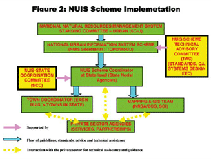
State of the art global communication technologies and thriving economy is facilitating Indian cities to compete in the global environment. The constant transformation of urban areas into complex entities has brought forth new challenges and opportunities for Planners to design and implement a variety of activities in spatial terms. There is need to tread common ground so as to address problems and issues in the right perspective to assist cities in coping with economic realities and thereby produce high quality responsive environment and demonstrate successful urban solutions.
Prof Madhav N Kulakrni.
A member of Coordinates family.
We had been fortunate to have his guidance for last two years.
His sudden demise has left us in shock.
His name itself was synonym of GPS/Geodesy in India.
An irreparable loss to GPS community and science.
We share our heartfelt grief with the bereaved family and pray for strength to …

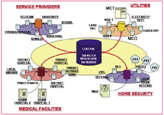
In recent past , humanity has suffered an increasing number of natural disasters affecting more than 2.5billion people, killing 478,100 and causing economic losses of about US$690bn (UNEP/ GRID-Arendal, 2005). Some of the distinctive instances are: December 2004 Indian Ocean earthquake and its concomitant tsunamis, The US eastern coast and Central America, hurricanes Katrina, Rita, Mitch, Stan and Wilma in September-October 2005, Pakistani earthquake of 2005, and now the current avian influenza in Asia and Europe. Natural and manmade tragedies, such as earthquakes, foods, nuclear catastrophes, pose an ever-present challenge to emergency services. Victims and societies at large have responded differently in each case. Some were heroic, some responsible but many panicked and responded irrationally. This aggravated the already bad situation. All of them could have responded more effectively if they were better informed and aright managed.

Tsunami is a series of traveling waves of extremely long wavelength generated primarily by earthquake occurring below and near the ocean floor. Underwater volcanic eruptions and landslides can also generate tsunami. Though the return period of tsunami is infrequent, the destruction done by tsunami is widespread, in terms of life and property. The most devastating tsunami occurred in December, 2004 affected the coastal countries of the entire Indian Ocean. It became necessary to set up a system in India to monitor seismic activity and sea level to evaluate potentially tsunamigenic waves and disseminate tsunami alert or warning.

Sunderban, one of the largest mangrove forests in the world, is located in the deltaic region of Ganga and Bramhaputra rivers in India and Bangladesh. The impact of biotic and abiotic factors on Sunderban is enormous (Rao, 1959), due to which the area has got reduced to nearly half during the past few centuries (Blasco, 1975; Naskar and Guha Bakshi, 1982; Naskar, 1985).
The mangrove-forested area of Sunderban (including portions in Bangladesh) was recorded to be 20,000 km2 by Clark (Annon., 1895), and 17,500 km2 by Prain in 1903. Grif?th (1982) reported that mangrove forests in the Sunderban covered over 4264 km2 and 4109 km2 respectively in India and Bangladesh during early eighties. The present area of Sunderban is 2081 km2 (Anon., 2001).
The debate is intense.
So are interests, and the clash of interests.
Conflicts are visible.
Equally visible is the cynicism displayed by some.
We could see all these forces at play in the Munich
Satellite Navigation Summit last month.
Still, there is a hope.
There is also a strong sense of conviction, commitment and confidence.
Galileo will happen.
It has to.
It is just a …


 (5.00 out of 5)