

The territory of Bulgaria is one within the Balkan Peninsula region with active tectonics and seismotectonics. A number of geodynamical investigations try to give an…
SATCOM has launched two new SAILOR satellite navigation receivers. Both the SAILOR 656X GNSS and new SAILOR 657X DGNSS DGNSS are black-box products designed to be part…
U.S. Transportation Secretary Anthony Foxx and FAA Administrator Michael Huerta recently announced the creation of a task force to develop recommendations for a registration…
Asia-Pacific Economic Cooperation (APEC) member economies are encouraged to implement the Intelligent Transport Systems (ITS) to enhance the efficiency…
Blue Marble Geographics has released an update to the Global Mapper LiDAR Module. The latest edition of the module includes numerous functional enhancements and performance improvements that have been designed to improve the quality and utility of LiDAR and other point cloud data…

Geoinformation is the global language that decision-makers all understand. This places the geoinformation sector, with its technologies and solutions, in a key position to deliver information that can be used to make decisions…

Survey Department, under the Ministry of Land Reform and Management, is the National Mapping Organization (NMO) of Nepal. The Department is responsible…
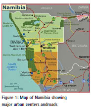
The number of people living in informal settlements around the world is difficult to measure precisely, but some estimates put it at close to one billion, or almost one…

Geospatial information systems provide the technology and tools to generate knowledge and added value in identifying problems and assessing alternative courses of action…


 (5.00 out of 5)