| Conference | |
Bridging the gap between open and institutional mapping
| As geospatial technology becomes an integral part of our daily lives, our ‘worldview’ grows and the world becomes a ‘smaller’ place. The technology itself has many facets, managed and used by a growing number of people. To understand how the interactions are taking shape among the various players of geospatial technology, the Space Applications Centre (SAC), Ahmedabad hosted the XXVIII INCA International Congress, under the theme ‘Collaborative Mapping & Space Technology’, from 4-6 November 2008, at Gandhinagar.
The Indian National Cartographic Association (INCA) is a non profit professional body of cartographers, established in 1979, at Hyderabad, India. Besides the annual international conference the association also holds a nation wide Map Quiz for school children. Two special lectures, one in the memory of Raja Todar Mul, who revolutionised the land revenue and collection system in the reign of Emperor Akbar; and the other in the memory of Prof. SP Chatterjee are now a hallmark of the congress.
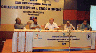
Maj. Gen Tanwar, Dr. PK Srivastava, rof. Armin Gruen, Prof. AR Dasgupta, Dr. Kaushal (L to R) at panel discussion Mr. Narendra Modi, Chief Minister of Gujarat, elaborating on the tremendous impact of technology, especially geospatial technology on e-governance, said, ‘Hope it will be widespread and available to all’, as the Chief Guest at the inaugural function of the Congress. Mr. Modi also distributed the prizes to the winners of the INCA Map Quiz 2008. Dr. G. Madhwan Nair, Chairman ISRO, released the Souvenir cum Abstract of the congress, as the guest of honour and also delivered the Todar Mul Memorial Lecture under the title ‘Benefits of Space to the Society’. Echoing Mr. Modi’s words in the context of congress Dr. Nair suggested that the forum needed to discuss the Map policy and how the data can be made available ‘more freely’. The three days of the congress were packed: with parallel technical sessions in three halls of the venue, the Cambay Spa & Resorts. The technical sessions were conducted under seven themes and included special sessions, plenary sessions as well as a youth forum. The sessions were informative and thought provoking, and the congress proved to be a platform for the stalwarts as well as the budding talent in the profession. The exhibition halls – one focussing on the private industry and the other on the government organisations – served as ideal meeting and discussion points for the delegates. The panel discussion, ‘Open vs Institutional mapping’ brought to fore the issue on everyone’s mind – ‘availability of maps’, in the concluding session of the congress. The five panellists represented the full spectrum of interests and views. Maj. Gen Tanwar, from Survey of India, said an assessment should be done to evaluate the map needs of the people. Dr. PK Srivastava, SAC, and President INCA, said there was a need to improve the quality of the maps ‘whether in an open of closed way’. Prof. Armin Gruen, Swiss Federal Institute of Technology, Zurich, who also delivered the keynote address at the inauguration, felt thatboth the high end and low end trends of mapping would develop, but mixing the data would not be a good idea. Prof. AR Dasgupta, Distinguished professor, BISAG, who also delivered the Prof. SP Chatterjee Memorial Lecture, said, ‘open (mapping) is here to stay, but open cannot replace everything’. He also felt that the common man will not wait for maps, they will get them from wherever they can. Dr. Ashok Kaushal, Country Manager India, PCI Geomatics, said that the distinction between data and software is now blurring and the value of the web should be recognised. With active participation and questions from the audience the conclusion was ‘Let us live with both and let us say AND – Open and Institutional mapping’. At the valedictory session awardees of the Young Researcher grants were announced.The XXVIII INCA International Congress thus proved to be the ideal forum to raise the various issues facing the geospatial community in India and abroad. As INCA prepares for the next conference to be hosted by the National Atlas and Thematic Mapping Organisation (NATMO) in Kolkota, we also hope that it will become a forum to bring solutions to problems faced by the geospatial community at large. |


 (No Ratings Yet)


