
Articles in the News Archives Category

Japan launches Michibiki 2
Japan launched an H-2A rocket which carries the satellite called “Michibiki No.2” from a space center in Tanegashima, southern Japan.
The first Michibiki satellite was launched into space in 2010 on a trial basis and two more satellites will be sent later this year, according to the Cabinet Office. Once the …
Teledyne CARIS reacts to IHO request to support latest ENC Validation Standard
CARIS™ has announced the adoption of Edition 6.0 of IHO Publication S-58 for ENC validation checks, in the latest re lease of CARIS S-57 Composer™ 3.1.Its internal and customized quality control tests have been reorganized, rewritten and extended to match the standard. New …
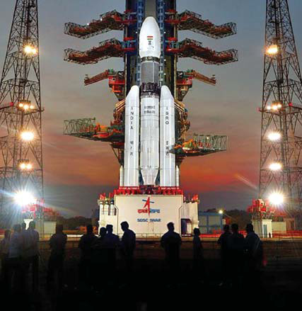
Additional eight satellites for Galileo
Europe’s Galileo navigation constellation will gain an additional eight satellites, bringing it to completion, thanks to a recently signed contract. The contract to build and test another eight Galileo satellites was awarded to a consortium led by prime contractor OHB, with Surrey Satellite Technology Ltd overseeing their navigation platforms.
This …
Icaros releases Version 5.0 of OneButton™
Icaros Inc. has released version 5.0 of OneButton™ Standard and Professional image processing software for UAVs. It has been developed for geospatial end users to easily and automatically generate precise, fully orthorectified 2D maps and 3D models from frame-based aerial imaging systems. Originally engineered for manned aircraft sensors, the …
Leica Ready now offered on Liebherr dozers, excavators
Leica Ready machine control kits will now be offered on dozers and excavators by Liebherr, one of the world’s largest manufacturers of construction machinery. Working with high precision GNSS, Leica Ready kits bring increased accuracy and improve efficiency up to 30 per cent. Enabling swift and fast …
STMicroelectronics and Allystar partnership
STMicroelectronics is working with Allystar to develop and market GNSS solutions for automotive products and other applications. Allystar is a spin-off from CEC Huada Electronic Design Co. Ltd. and a Chinese GNSS chip designer. ST and Allystar are already co-marketing products for the automotive market and cost-competitive products for the consumer …
First Galileo open service performance report published
The European GNSS Agency (GSA) has published its first Galileo Open Service quarterly performance report. It covers the first three months of 2017, is available online in the GSC Electronic Library.
Following the Declaration of Initial Services in December 2016, the GSA will publish a new Galileo Initial …
GHGSat unveils Satellite Imagery of Greenhouse Gas
GHGSat Inc. has unveiled sample imagery from its demonstration satellite, Claire (or GHGSat-D), which has detected emissions of methane from a hydroelectric facility under construction in Africa. GHGSat’s vision is to become the global reference for remote sensing of greenhouse gas (GHG) emissions from industrial sites, using satellite …
Thomas & Hutton Announces New Certified UAV Remote Pilots
Thomas & Hutton (T&H) has announced its new Certified Remote UAV Pilots. Survey Party Chief, Brad Lariscy; Staff Surveyor, Cliff Wilson; and GIS Analyst, Preston Evans, both recently earned this certification. The Remote Pilot Certification is a requirement in order to fly drones legally and requires …
RuggON announces the VX-601
RuggON Corporation has launched a new rugged in-vehicle terminal, the VX-601, which provides superb visibility from a large, bright, sunlight-readable touchscreen display; great durability; seamless connectivity and communications; as well as smart power management. The VX-601 is suitable for challenging environments and diverse applications such as intralogistics, cold chain logistics, waste …


 (5.00 out of 5)