Articles in the News Archives Category

Droneshield join hands with Thales
DroneShield has entered into a Teaming Agreement with Thales Programas De Electronica Y Comunicaciones S.A.U. (“Thales”) (a Spanish subsidiary of Thales S.A.), whereby Thales will utilise and promote DroneShield’s products in its defence and security contract bids in Spain involving counterdrone aspects.
Drones help map sea level rise
Drones can be used to …
Actifio teams up with Onix
Actifio, enterprise Data-as-a-Service (DaaS) software provider, has announced an alliance with Onix, provider of cloud computing solutions and consulting services. This alliance will provide Onix customers with a powerful cloud infrastructure backed by data replication and disaster recovery services powered by Actifio, allowing enterprises to bring their on-premise environment to the …
Septentrio boosts its portfolio with mosaic GNSS module
Septentrio has announced the launch of the mosaic high precision GNSS receiver module. Small in size, but huge in performance, this module sets a new benchmark for the mass market positioning building blocks. It supports more than 30 signals from all six GNSS constellations, L-band and various satellite-based …
Virtual Surveyor 6.1 handles more than drone data
Virtual Surveyor 6.1 now handles on-thefly projections that previously required a separate software package to set the data in the proper coordinate system. It has become popular among surveyors because it bridges the gap between UAV photogrammetric processing applications and engineering CAD packages. The software generates an interactive …
Navigation without relying on satellites
The UK’s first quantum accelerometer for navigation has been demonstrated by a team from Imperial College London and M Squared.
Most navigation today relies on a GNSS, such as GPS, which sends and receives signals from satellites orbiting the Earth. The quantum accelerometer is a self-contained system that does not rely on …
FCC approves use of Galileo GNSS in the US
The FCC has granted in part the European Commission’s request for a waiver of Commission rules so that nonfederal devices in the US may access specific signals transmitted from the Galileo. While private users were free to use the European GNSS, with this ruling entity such as …
£1.5 million geospatial competition open to improve public services
The Geospatial Commission has partnered with Innovate UK to launch a new government competition, where organisations can apply for a share of £1.5 million to fund projects which use data linked to a location. Between £50,000 to £750,000 could be granted to eligible organisations.
The aim of the …
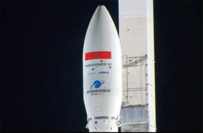
New China-Brazil Earth resources satellite in launch in H2 2019
The China-Brazil Earth Resource Satellite- 4A (CBERS-4A) will be launched in the second half of 2019, according to Li Guoping, secretary-general of the China National Space Administration (CNSA).
With a spatial resolution of two metres, the CBERS-4A satellite will offer the highest precision among CBERS satellites, though …
Four more galileo satellites brought online
According to the European Global Navigation Satellite Systems Agency (GSA), Galileo Satellites GSAT0215, GSAT0216, GSAT0217, and GSAT0218, launched in December 2017, have been commissioned for operational use.
Since October 12, all Galileo satellites that were launched last year (in December) are usable for service provision, according to the GSA. …
Eos supports Haiti Outreach in its sustainable water initiative
Eos Positioning Systems, Inc.® (Eos) is giving back to the global water community by supporting Haiti Outreach’s sustainable water initiative. Haiti Outreach is a 21-year-old nonprofit organization dedicated to helping Haiti become a developed country. Haiti Outreach collaborates with individual Haitian communities to create and maintain …


 (5.00 out of 5)