Expanding horizons in a shrinking world
Aug 2007 | Comments Off on Expanding horizons in a shrinking world
| |
15-19 July 2007, Cambridge
THE theme of the Cambridge Conference was “Expanding horizons in a shrinking world”. The conference was attended by 220 delegates from 70 countries. The conference was sponsored by ESRI, Intergraph, Oracle, Rolta, Topcon, DGC, Trimble, GeoEye, Ordnance Survey and i-spatial.
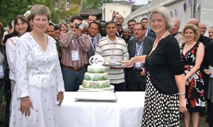
The conference was offi cially inaugurated by Kate Adie OBE, BBC’s chief news correspondent. She shared a number of stories from her career as a BBC reporter including the one highlighting the importance of maps. Vanessa Lawrence welcomed the delegates of the conference.
The opening plenary addressed by Air Marshal Stuart Peach, Chief of Defence Intelligence explained how geographic support to military operations has changed over a century. The second plenary was on “Dissolving Borders – from national mapping to regional and global SDIs”. It came out of the discussions and presentations that the Nationally produced GI is often inconsistent with neighboring countries and so fails to meet the needs of sustainable development. However, Africa has a vision for spatial data to permeate every aspect of society and for it to be consistent across the continent. There were fi ve workshops scheduled on the fi rst day. The workshop on “Land Administration for the 21st century” continued the debate on the need for accurate surveys and the role of the private sector in custodianship of records. The workshop on “Models for Geospatial Rights Management” observes that the copyright law is complex and rights provide to users are not always clear. The challenge is fi nding way to standardize licensing terms so technology can implement them. Al Gore’s award winning documentary, An Inconvenient Truth was screened in the third workshop. The fourth workshop Imagery Matters discussed on differing value of imagery, currency, fi tness for use and ease of interpretation for the growing user base. The fi fth workshop “Winning support from key stakeholders”highlighted the importance of time, stick and carrots approach, political support, rules and engagement, regular and effective communication, coordination and mutual cooperation, understanding the cost benefi t equation and patience.
|
On 17th July, the fi rst plenary focused on “New technologies – isrupting or Enabling”. It came out that disruptive technology often leads to innovative uses, frequently unrelated to the original design intent. The second plenary “Risk and Disasters” highlighted the wide variety of disaster forms and differing responses. Five workshops also conducted during the day were on Partnering, Mapping for Disaster Response, Education, Licensing and Reference Framework for Active Networks. The highlight of the day was the Hotine Lecture by Prof Sir Martin Sweeting OBE, Executive Chairman – Surrey satellite Technology Ltd and Director- Surrey Space centre. He gave lecture on use of small satellites for remote sensing and navigation.
|
On 18th July, the fi rst plenary “Business Models and Sustainability” shared experiences of Ghana, Norway, Canada and Britain. Ghana presentation focused on the importance of government subsidy needed to achieve cost recovery whereas Norway’s contention was to separate the State and commercial activities. The Canada experience focused on data standardization to meet customer needs. Britain emphasised that the value-added partnerships facilitate Trading Fund Models. The second plenary was addressed by Jon Williams, World News Editor of the BBC. He said that it is very diffi cult to gain the trust of the audience but it is very easy to lose it. The workshops of the day were on Capacity Development, Mapping for Disaster Response, Archiving Geospatial data for long term preservation, the business of SDIs and Customer Experience Thinkings.
|
On 19th July the fi rst plenary “From Silos to Webs – How do we Make Interoperability a Reality?”. Spatial information is a fundamental layer of an SDI, but is not the only consideration. Technical changes and developments are solvable. Organisational change in the NMO community will take time and represents a greater challenge. The second plenary “Beyond Mapping – Geo-enabling Government and the Citizen NMOs’ role in geo-enabling government was examined from the perspectives of land management and of wider technology, science and business trends. Given the speed of change in geospatial information use, NMOs need to re-think priorities and strategies, address resistance to change and the increasing levels of user expectation, while continuing
to be concerned with information quality.
|
The Final Plenary was on “Future of NMOs – Replaced by NSDIs or Commercial Interests? Views on the future of National Mapping Organisations (NMOs) were expressed by the panel before opening the discussion. It was agreed that NMOs have a future but must continue to be relevant to customers depending on what they are tasked to do and how they are tasked to do it. They must be agile, responsive and capable of adapting to change.
|
An interesting feature of the conference was a daily newsletter on which this report is based on. The Cambridge conference was well designed and well organized with a very high quality content. The focused on relevant issues and was able to engage delegates on those topics. It also refl ected the wonderful leadership Ms Vanessa Lawrence and a great team spirit of the organizing team led by Mr Hugh Buchanan, Ms Sallie White and Ms Clare Hadley. Kudos to the entire Cambridge Conference team.
|
|
|


 (145 votes, average: 1.03 out of 5)


