India and Russia are planning for a joint venture to produce dual band GPS / GLONASS global positioning receivers for civilian and military use.
“We are actively working on a project to establish a joint venture on Indian territory to produce various navigation equipment. A group of our negotiators will head there for another round …
Pythagoras is a standalone CAD program that focuses on markets concerning surveying, constructing, and engineering. Its drawing and calculation functions give the user the possibility to treat measurements accurately and to finish drawings swiftly. With the modular system, the user can compose a software package according their needs. Digital terrain models, road design, importing field …

Volume VI, Issue 3, March 2010
Zip
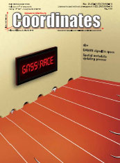
GNSS race?
Brend Eissfeller, Chris Rizos, David A Turner, Hiroaki Tateshita, Sergey Revnivykh, Sharafat Gadimova
GAGAN signal in space – validation and utilization
Rajneesh Gupta and A S Ganeshan
A synchronisation approach to automate spatial metadata updating process
Hamed Olfat, Abbas Rajabifard and Mohsen Kalantari
My Coordinates
EDITORIAL
His Coordinates
Donald G Degyrse
News
INDUSTRY | GPS | GALILEO UPDATE | LBS …

Metadata is commonly defined as “data about data” and also plays a critical role in any Spatial Data Infrastructure (SDI) initiatives. Metadata not only provides users of spatial data with information about the purpose, quality, actuality and accuracy of spatial datasets, but also performs vital functions that make spatial data interoperable, that is, capable of being shared between systems…

A GAGAN (GPS Aided Geo Augmented Navigation) is an Indian SBAS (Satellite Based Augmentation System) intended to provide accurate and reliable navigation information for all phases of flight over the Indian FIR (Flight Information Region) and in the adjoining areas applicable for safety-of-life operations meeting the performance requirements of ICAO. The implementation of the GAGAN program is being realized through the following two phases…

There are some countries trying to develop their own GNSS system. Is there any race? If yes, how appropriate and where would it lead to? Here are some views
“Well first of all there is the issue of robustness and putting all your eggs in one basket – that is one aspect and a major legitimate concern. The other, is a matter of national pride. In Europe there is a feeling that GPS dominates things…
Broadcom Corporation single-chip GPS solution for mobile devices sets new standards in performance and low power consumption with stateof- the-art sensitivity and navigation performance.
www.broadcom.com
Tweet
ERDAS announced support for WorldView-2 satellite products. Using ERDAS IMAGINE and LPS 2010, GEOINT and military analysts, state and local governments, civil organizations, first responders, and non-governmental organizations can now transform WorldView-2 imagery into timely, relevant and accurate geospatial intelligence.
www.erdas.com
Tweet
Indian Space Research Organisation Chairman K. Radhakrishnan said the flight- testing of the indigenous cryogenic stage of the GSLV D3 would be conducted in April. The vehicle would carry GAST-4, a communication satellite. “Though we had several GSLV flights, we were using the Russian cryogenic stages,” he said.
http://beta.thehindu.com
Tweet
Brazil and China shall launch the fourth China Brazil Environmental Remote Sensing (CBERS) satellite in 2011. At the initial phase (1988-2003), two satellites, CBERS-1 and CBERS-2, were sent into space. China was responsible for 70 percent of the first series of satellites. The construction of CBERS-3 and 4 will be shared equally.
Xinhua
Tweet


 (5.00 out of 5)