| Mycoordinates | |
A strategic approach to data sharing
|
Mansour Ahmadi Foroushani
|
||||
|
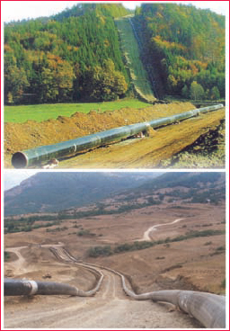
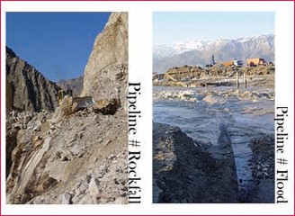
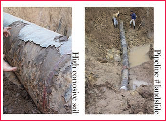
RECENTadvances in information and communication technology (ICT) have resulted in a changing environment with many interdependencies between organizations. There are various data services produced and consumed within the process of enhancement of pipelines project. This happens along the various phases; feasibility study, land allocation, execution and operation. Problems in data sharing arise from the fact that data services are not properly documented resulting in difficulties in updating data, data duplication and long administrative inter–organisational procedures[1]. This article presents a method for elaborating the trade-off between existing situation and the desired future in case of improving conditional data sharing. Figure 1: designers, planners and decision-makers are trying to minimize threats by choosing the best alternative for new pipeline dtream. IntroductionIranian Oil Pipeline and Telecommunication Company (IOPTC) is one of the distributed companies having eleven main subsidiaries located in different geographical locations. Oil travels a long distance from oil wells to refineries and distribution points all over the nation through underground pipelines. Its mandate can be broadly categorized in four The first and foremost is the challenge of developing the petroleum pipelines network. New Oil Pipeline Project (NOPP) and Relocation Potential Pipeline Project (RPPP) need verification of feasibility study that shows conflict between technical design and environmental aspect. However, it can be resolved with minimal effect on the project schedule (Figure 1). Obviously, to come up with an inter-organizational agreement, the long administrative procedure is one of reasons that the data sharing is not taking place as it should. The pipeline external corrosion is a great threat caused by natural chemical interactions. American Petroleum Institute (API) suggests other risk factors such as pipe material and manufacturing process, highly CORROSIVE SOIL, and highly volatile products. In addition, landslide rock-fall, earthquake and flood are the most serious geological hazards affecting on-route selection of new pipeline. So far, only feasible routes have been approved by decision makers. The Proposed Route is selected to minimize technical difficulty, environmental impact, land conflict and cost. Environmental Protection Agency (EPA) Region III suggests that when establishing the frequency of assessment, three risk factors should be taken into consideration; specific product differences, location related to the ability of the operator to detect and respond to a leak (Figure 2). ObjectivesThe objective of the new pipeline project profile based on data sharing are; * To understand current GI situation of the IOPTC and stakeholders Figure 2: natural chemical interaction, natural hazards o enhance IOPTC performance and develop existing informal data sharing according to the following requirements: * All stakeholders should have access to the information |
||||
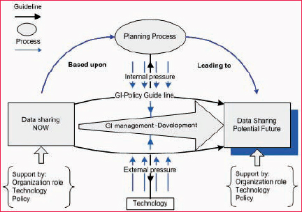
Investigation on existing practiceTable 1 represent MODELS that all stakeholders (company professional, * Model (No: 1) developed by two managerial and institutional aspects is based on Taxonomy of Spatial Data Sharing adapted from Calkins and Weatherbe 1995. Trade–off between existing and target practiceAn appropriate plan, data management and technology will affect the trade-off between existing and target practices. Each aspect of Geo–information use is to be compared alongside a corresponding guiding principle. Both planning process (internal) and Technology (external) pressure is against the guideline that is supported by GI-policy. If any aspect of Geo-Information use is not in line with the guideline, future investigations need to be made. (Figure 3) Planning process (internal pressure)Collection and maintenance The aim is to keep a record of what data is needed to perform a certain task, and where it is being sent to. Because of the Geo-Information value, the planning process needs to find what data is required? Where that data might be sent? And an event history to record what happens with that data? Update, standards and metadata Planning process needs to define standards by adding metadata element to meet up-to-date data. Data can be confusing or misleading if you don’t know who, what, why, when, where, and how it was created.[2] Real-time data availability If the data and the relevant Geo-Information is recorded to the specific Figure 3: sharing in transition (model adapted from Brian wilson – system thinking 2006) system of NOPP/or RPPP centre, it will be very easy to track and trace the progress of inter-organizational interaction without recollecting data. It can reduce the loss of data in data sharing and speed up data analysis. Technology (external pressure)The current status of technology offers many opportunities. From the Geo- Information management point of view, the planning process will use information technology to collect information very quickly. This will include the following components. Optimum technology Technology is articulated by hardware, software, operating system and communication protocol. How to store the required information? How to access and prepare access routines? Obviously information technology has become an important aspect in developing countries to achieve economic progress and the relative success in this area [3]. With growing data sets and more complex maps, data upload speeds can limit the use of the system [4]. Therefore, a user friendly information technology should be chosen. Dataset framework Framework data and information comprising themes that are continually needed and used by managers is another critical requirement. According to Frank 1992, [5] an organization contemplating sharing of spatial data needs to carefully define spatial objects, attributes, and data quality associated with these objects.[1] * Acquired data is used as a backdrop |
Building the matrix of changeThe Matrix Of Change system consists of three matrices and a set of stakeholder evaluations. It detects harmonizing and interfering practices and presents an overview of an interlocking organizational system. Matrix construction then proceeds in four steps; Critical process, definition of system interaction, transition interaction and definition of survey stakeholder (Figure 4). Critical processFirst list is the existing goal, business practice and ways of doing NOPP/ RPPP profiles. However, it is rare that all-important practices can be identified in advance. A second list will describe the target practice. Identifying the most important process can be quite difficult but certain analyses, such as SWOT analysis result can help. Processes
|
||||||||||||||||||||||||||||||
|
||||||||||||||||||||||||||||||
|


 (No Ratings Yet)


