Articles in the Applications Category


AbdelKarim Fawwaz AlBataineh
Faculty of Administrative and Financial Sciences, Department of Finance & Banking, University of Petra, Amman, Jordan
Abstract
This study explores the implementation of blockchain technology, specifically smart contracts, within the Land Registry and Survey Department to enhance sustainable development in Jordan. Utilizing a quantitative, cross-sectional survey design, the research targeted 12,450 employees of the Jordanian …

A Geospatial assessment of urban expansion suitability using multi-criteria framework
Shashi Shekhar
Scientific Officer, Himachal Pradesh State Pollution Control Board
Abstract
Rapid urbanization in fragile Himalayan ecosystems necessitates robust land-use planning that balances development needs with environmental conservation. This study utilizes a Multi-Criteria Decision Support (MCDS) system, implemented via the Weighted Linear Combination (WLC) method within the Google Earth …

Innovative solutions and applications using ChatGPT, an advanced AI language model
Fatih Taktak
Uşak University, Department of Architecture and Urban Planning, Uşak 64800, Türkiye
Uşak University, Graduate School of Education, Department of Urban Transformation, Head of Department, Uşak 64200, Turke
Abstract
This study investigates the potential of the advanced AI model, ChatGPT, in providing innovative solutions and applications within Geomatics …

The findings of this study show the potential of using UAS-lidar as a sampling tool for estimating and monitoring AGB and other forest structural attributes.
Hastings Shamaoma
Department of Urban and Regional Planning, Copperbelt University, 21692 Kitwe, Zambia.
Paxie W. Chirwa
Forest Science Postgraduate Programme, Department of Plant and Soil Sciences, University of Pretoria, Private Bag X20, Hatfield, Pretoria …

We present a detailed landslide vulnerability map developed on the Google Earth Engine (GEE) platform using a Weighted Overlay Model.
Dr. Satish Kumar Negi
Associate Professor, Department of Geography, Govt. Degree College Dharampur, Solan, Himachal Pradesh, India
Shashi Shekha
Scientific Officer, H.P. State Pollution Control Board, Shimla, Himachal Pradesh, India
Abstract
This study addresses the escalating threat of landslides in Himachal …

The Central and State governments have committed the policy of Jahan Jhuggi-Wahan Makaan, that is In-Situ Slum Resettlement in Delhi, replicating the Dharavi Model of Mumbai. While the policy is already mandated in the Delhi Master Plan, its implementation involves putting in place people centric, evolutionary and support-based tools that are more longitudinal and avoid …

The Delhi Pollution Control Committee (DPCC) on 9th May 2025 invited concept notes from the IITs, professionals and NGOs on combating air pollution in Delhi. The author submitted this paper to the DPCC
A. K. Jain
Worked as Commissioner (Planning), Delhi Development Authority and as a member of the Committee of the Ministry of Housing and Urban …

Yamuna is the identity of Delhi. While the immediate cleaning operations include trash skimming, weed harvesting and dredging, these will have to be long-term, overarching the entire region
A. K. Jain
Worked as Commissioner (Planning), Delhi Development Authority and as a member of the Committee of the Ministry of Housing and Urban Affairs on the DDA (2015). …
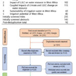
This study aims to review the existing literature on the impacts of climate, and LULC changes on the sustainability of irrigation water in West Africa.
Gemechu Fufa Arfasa
Department of Natural Resource Management, Wolaita Sodo University, Sodo, Ethiopia
Ebenezer Owusu-Sekyere
Faculty of Natural Resources and Environment, Department of Environment and Sustainability Sciences, University for Development Studies, Tamale, Ghana
Dzigbodi Adzo …

Monitoring and managing the impacts of natural resources due to sand mining activities is of utmost importance to ensure their sustainability
Rahma Rashid Amour
Corresponding author, Department of Computer Science and Information Technology, School of Computing, Communications, and Media Studies, State University of Zanzibar, Zanzibar, Tanzania.
Haji Ali Haji
Department of Computer Science and Information Technology, School of Computing, …


 (5.00 out of 5)