Articles in the News Archives Category
Prototype sensor against GNSS signal threats
A new prototype sensor developed by the NATO Communications and Information Agency has completed a significant round of testing, marking a step forward in NATO’s electromagnetic warfare capabilities. The sensor, GANDALF 4, underwent a series of tests at an advanced anechoic chamber operated by the NATO Support and Procurement Agency. …
Geospatial technology delivers 3D city model of Doha
The Centre for Geographic Information Systems (CGIS), the official geospatial agency of the State of Qatar, successfully delivered the country’s first advanced, vectorized, watertight 3D city model of Doha.
CGIS collected, in collaboration with Khatib & Alami, aerial data using Vexcel Imaging’s UltraCam Osprey 4.1—a large-format photogrammetric camera system …
Segway expands Navimow lineup with X3 Series launch
Segway Navimow has launched the X3 Series, the latest addition to its portfolio of boundary-cord-free robotic lawnmowers. The range consists of four new models – the X315, X330, X350 and X390 – and is designed to handle unprecedented lawn sizes with precision, mowing areas of up to 10,000m² …
Disaster response with satellite technology
Juvare and ICEYE have announced a strategic partnership designed to deliver unprecedented situational awareness and actionable insights to emergency management agencies, insurers, and government organizations worldwide. Through this collaboration, ICEYE’s high-resolution, all-weather satellite solutions will be integrated into Juvare’s …

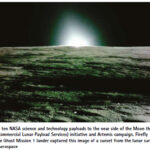
NASA science continues after Firefly’s Afirst moon mission concludes
After landing on the Moon with NASA science and technology demonstrations March 2, Firefly Aerospace’s Blue Ghost Mission 1 concluded its mission March 16. Analysis of data returned to Earth from the NASA instruments continues, benefitting future lunar missions.
As part of NASA’s CLPS (Commercial Lunar Payload Services) …
UK Positioning, Navigation and Timing: Overview
As of March 2025, the UK’s Framework for Greater PNT Resilience, introduced in October 2023, continues to drive efforts to enhance Positioning, Navigation, and Timing (PNT) services. A significant milestone was achieved on 20 November 2024, when the National PNT Office, established within the Department for Science, Innovation and Technology …
AIBOT achieves eVTOL milestone at Norton
AIBOT has successfully conducted a f light test at the Unmanned Aircraft Systems (UAS) Center at San Bernardino International Airport (SBD) under the newly established Norton Test Range. The flight was conducted through a partnership with the FAA’s UAS Test …
FCC launches proceeding on GPS alternatives
The Federal Communications Commission (FCC) recently launched an inquiry to explore commercial technologies that would complement the Global Positioning System (GPS). Although GPS is indispensable to America’s economic and national security, it represents a single point of …
Latest eBee VISION application software
AgEagle Aerial Systems has introduced version 2.1.0 of its eBee VISION application software, designed to significantly enhance UAV capabilities. The update expands the system’s functionality, introducing circular and grid mapping features. It can continue missions in GNSS-denied environments and allows manual deactivation of GNSS …
Eos Positioning Systems redesigns Eos Tools Pro on iOS
Eos Positioning Systems has launched a redesigned Eos Tools Pro app on iOS. The redesigned app includes a reorganized settings menu to improve the organization of all configuration options, offering a centralized space for users to manage their GNSS preferences and optimize workflows. The new interface has …


 (5.00 out of 5)