Articles in the News Archives Category

New remote-sensing system maps Antarctic vegetation
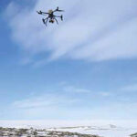
Queensland University of Technology (QUT) researchers have developed an advanced remote sensing method for accurately detecting and mapping Antarctica’s delicate moss and lichen growth, the mainstays of the continent’s fragile ecosystems.
The research team also developed a way to survey Antarctica’s vegetation that is non invasive and will enable accurate surveys …

GeoTech Overseas chooses UltraCam Osprey 4.1
GeoTech, a partner of MipMap Holdings, has recently expanded its technological capabilities with the acquisition of Vexcel Imaging’s UltraCam Osprey 4.1 aerial camera system. It will support GeoTech’s groundbreaking project to create a high precision Digital Twin of Jeddah, Makkah, Al Ula, NEOM and other cities, covering both urban and …
Galileo OSNMA is now fully operational
The European Union Agency for the Space Programme has officially declared its Galileo Open Service Navigation Message Authentication (OSNMA) initial service fully operational on 24th July’2025. OSNMA introduces a data authentication mechanism for Galileo Open Service users and is available …
TDK expands MEMS inertial sensors portfolio
TDK Corporation has expanded its MEMS inertial sensors portfolio with the Tronics AXO315®T0, a high temperature MEMS accelerometer with ±14 g input range and a digital interface for measurement while drilling (MWD) applications in the energy market. With a typical bias drift of less than 1 mg without recalibration after …
ESA teams up with Leonardo against satnav jamming
The European Space Agency (ESA) and Leonardo are embarking on a joint project to explore smart antennas. Representatives of ESA and Leonardo signed a contract at the Paris Air Show to research and develop machine learning techniques to steer antenna …

DIGIPIN launched
IIT Hyderabad (IITH), in partnership with the Department of Posts and the National Remote Sensing Centre, ISRO, has launched DIGIPIN—a compact, human-readable, geospatial addressing system set to redefine how India navigates, delivers, and connects.
DIGIPIN offers a precise, intuitive, and inclusive code that represents the exact latitude and …
Mosaic-G5 GNSS receivers
Septentrio has unveiled mosaic-G5 modules, its smallest GNSS receivers yet, measuring only 23 mm by 16 mm and weighing as little as 2.2 grams. The ultra compact form factor and reduced power consumption of mosaic-G5 receivers enable reliable, high-accuracy positioning. The quad-band mosaic-G5 P3 and …
GeoTerra selects Vexcel’s UltraCam Merlin 4.1
GeoTerra, USA has acquired the UltraCam Merlin 4.1 2010 digital aerial camera system by Vexcel Imaging. This marks GeoTerra’s transition to Vexcel’s fourth-generation camera systems and reinforces their commitment to delivering versatile, reliable, and high accuracy imagery for engineering and government …
First All-Canadian Antarctic Expedition Draws Underwater Maps with High-Accuracy
In a landmark moment for Canadian science and technology, the first all Canadian Antarctic research expedition relied on Montreal-made Arrow Gold+™ GNSS technology for precise location data. In one of the most remote, harsh, and unmapped environments on …
Regulatory framework to support direct-to-device satellite services in China
China has released comprehensive regulations for direct-to-device satellite services, laying the foundation for domestic growth of the emerging sector. Seven government departments issued a notice April 30 entitled “Regulations on the Management of Terminal Equipment Directly …


 (5.00 out of 5)