September 2012:
ION GNSS 2012, September 17-21(Tutorials and CGSIC: September 17-18),
NAshville Convention Center, Nashville, Tennessee, USA. www.ion.org;

SEGS: A pro-poor agenda is paramount: Christiaan Lemmen, Christopher H Barlow, Dave Doyle, Ian Harper, Juerg Kaufmann, Keith Clifford Bell, Neil Pullar, Pierre Vincent, Rachael Knight, Robin McLaren, Stig Enemark, Teo CheeHai, Tony Burns;
A case for financing the `data’ as part of infrastructure: Dr Mahavir, Prabh Bedi;
Mobile Technology dynamics and industry economics: Ali Sarwar;

Objective of accuracy investigation In this study, accuracy investigation of the corrected MMS measurement data by LMU and the mapping data derived from these corrected data were carried out to establish the most appropriate land mark point asignment (position intervaletc.) method at GPS invisible period. The target mapping scale is 1/500 and required accuracy is 25cm RMS for both horizontaland vertical.

Significantly, this was the first annual conference that dedicated a specific stream to spatial information. The full day workshop convened by the International Federation of Surveyors (FIG) and the World Bank “Spatially Enabling Government and Societies (SEGS) for Sustainable Land Administration and Management” was an excellent complement to the overall conference theme on land governance.

Predominantly, two references bind the subscriber to the carrier for identifi cation, authentication and authorization i.e. Subscriber Identity Module (SIM) card and billing number. Near future could see mobile stores selling mobile phones without SIM cards. Inbuilt system-on-chip may require the subscriber to sign-in using their apple or Google accounts to access email, Skype and so forth

Surveyors have a rich history and recognized longstanding contribution to societies worldwide. This will always be part of the surveyors’ identity and I don’t think using new technology will change that. I don’t think maintaining domain identity is exclusive of integration. There is a big difference between integrating technologies and integrating professions. Surveyors have many new tools producing large amounts of data, such as LiDAR, highprecision imagery, and GPS.

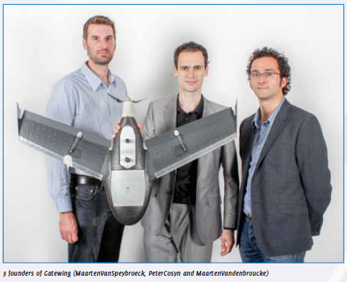
The idea for designing unmanned aerial systems (UAS) for rapid mapping originated from a doctoral dissertation in aerodynamics by Peter Cosyn, one of the three founders and now Director of R&D at Gatewing. Maarten Van Speybroeck, Director of Operations and Finance, was involved with this idea as subject for a thesis.
With Visual Stakeout (VSO) the virtual location of the point to be staked can be seen by a “fl ag” shown on the Triumph- VS camera image. This visual aid helps to navigate quickly to the point and makes stakeout jobs fast and fun. The VSO precision is better when closer to the target point and also better when the point is close to the crosshair.


 (5.00 out of 5)