| Policy | |
“Map the earth to enrich the globe”
|
||||
|
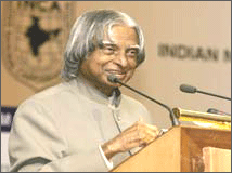
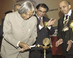
I am delighted to participate in the 26th Congress of the Indian National Cartographic Association (INCA). My greetings to the organizers, delegates of the Conference, cartographers, scientists and technologists, users of cartographic products and distinguished guests. India has a vision of transforming itself into a developed nation before 2020. There are number of missions which need inputs from cartography technologies that will certainly accelerate the process of development. The programme such as Bharat Nirman Programme including PURA (Providing Urban Amenities in Rural Areas), networking of rivers, infrastructure development in 63 cities through Jawaharlal Nehru Urban Renewable Mission, mapping of earthquake prone areas and recurring floods in north Bihar and Assam require vital inputs at the stage of planning and implementation level. The mission of INCA should be to assist the implementation of developed India vision using their core competence in cartography in partnership with ISRO, NRSA, Survey of India, State Remote Sensing centers, Thematic map making organizations, Indian Remote Sensing Industries, Academia, Research Institutions and other IT organizations. Hence, I would like to talk to you on the topic “Cartographers: Partners in National Development”. Let us now look at some typical requirements of rural and urban development programmes of the nation, where cartographers are major partners. PURA (Providing Urban Amenities in Rural Areas)India is on the mission of establishing 7,000 PURAs (Providing Urban Amenities in Rural Areas) in different parts of the country integrating six hundred thousand villages (2 lakh village Panchayats). This integration will bring prosperity to rural India. PURA envisages four connectivities: the physical connectivity of village clusters through quality roads and transport; electronic connectivity through tele-communication with high bandwidth fiber optic cables reaching the rural areas from urban cities and through internet kiosks; knowledge connectivity through education, skill training for farmers, artisans and crafts persons and entrepreneurship programmes. These three connectives will lead to economic connectivity through the establishment of enterprises with the help of banks, micro credit and marketing of products. Since the PURA Clusters need road connectivity, the optimum road alignment without damaging the environment, uprooting the trees and disturbing the water bodies is a prerequisite. The information has to be generated for each block for meeting the 11th plan demands of establishing number of PURAs in the State. As a part of physical connectivity, link roads emanating from PURA clusters joining the main roads have to be planned in such a way that they can meet the growing traffic resulting out of higher economic activity in the PURA Clusters. A combination of ground survey, satellite remote sensing data, and Aerial pictures has to be used to derive relevant maps at larger scale better than 1:10,000 and even at the level of 1:2000 as appropriate in a time bound manner within the next two years. Jawaharlal Nehru National Urban Renewal MissionThe Government of India has undertaken several initiatives to encourage sustainable urban development in the country, including the recent declaration of a national incentive-linked fund, the Jawaharlal Nehru National Urban Renewal Mission (JNNURM). The JNNURM covers 63 of the largest cities in India. The Ministry of Urban Development (MUD) has been designated as Executing Agency (EA) for the infrastructure and governance component of the JNNURM. India’s cities require structured infrastructural development, environmental upgradation and adequate urban infrastructure, particularly the planned sewage and drainage system. The entire infrastructure needs improvement quantitatively and in qualitatively. Urban development and management is necessary to deliver better quality of life to our citizens, considering the local and national economic growth. Thus, JNNURM envisages provision of modern drainage system, provision of drinking water in each house, electrical and electronic connectivity, rain water harvesting and water recycling and provision of congestion free roads. JNNURM is a time bound programme. It is very important for the cartographers to provide cartographic data for each of the 63 cities and towns, using the satellite imagery coupled with GIS. They should first establish the existing road network with contours, green areas, location of original water bodies, existing sewage and drainage systems. New alignment has to be provided keeping a 50 years growth profi le in mind updated at an interval of ten years. Availing temporal information obtained through satellite remote sensing will enable better planning and regular monitoring. Based on this study, they must provide new connectivity contours, the new sewage system alignment, possible transportation of sewage system remains after treatment and above all a multi-layered road system to remove traffi c congestion. It should be made mandatory for the city administration to use such data and information for decision making. Disaster ManagementEarthquakeThough India is rich in natural resources, many parts of India also faces different types of natural disasters such as earthquake, incessant down pour leading to localized fl oods, drought, avalanche and landslide in hilly areas, storms and tsunami. It may not be possible to avert the natural disasters, but the suffering and misery due to loss of life and adverse socioeconomic impact can be minimized. First the mapping of the earthquake prone areas with suitable details enables the detailed precautions in construction and emergency actions. A powerful-enough earthquake just a few seconds in duration can still make current maps suddenly out of date, at the same time severing power lines, gas mains and water pipes. Secondary disasters such as landslides may have taken place in some areas. Satellite images can provide updated views of how the landscape has been affected, while images before and after the event enable authoritative damage assessment as a basis for planning remedial action. Flood and water managementI have observed certain unique features in the river system of Bihar. Though Ganga, the main river is flowing from West to East, there are two types of flows coming into the Ganga. Because of the flow from both the directions no water is saved and everything goes to the Sea. Also, the main flood bearing river the Kosi when it comes into Bihar is already in the plains and we have to find innovative flood management techniques. Cartographers should provide high resolution maps in partnership with agencies involved in satellite imagery and aerial photography for planning water harvesting and water management system leading to flood control even in the steep slopes of hill area. An Open Letter:To: Dr A P J Abdul Kalam, President of India Sub: India has a VISION Dear Dr Kalam, While reading with great interest your vision articulated at 26th INCA 2006, India deserves nothing less than the best. The correct mapping of the Defense Series of Maps (DSMs), which will be produced by Military Survey Directorate and Survey of India as mandated in National Map Policy released last year, is extremely critical. Any thing less can lead to “life or death” of a war fi ghter. I interpret this “A dead war fi ghter would never return to tell us what was wrong”. Here, I would like to identify the contribution of geodesists of the Survey of India (SOI) towards the fulfi llment of the VISION. They must stop using the 19th century Indian Datum, 1980s “solutions” of the West, and an un-valid datum, which does not exist. Only a correct and accurate newly realized Indian Geodetic Reference System (IGRS) would provide the required geodetic foundation. The cartographers will never progress, if they will keep using the status quo or 16th century UTM projection with its problematic grid system for the Indian datum. They would have to come out of the bondage of the past and look towards the new concepts and solution(s). Fortunately, starting of the new DSMs and OSMs has provided the SOI a unique opportunity to lead the “change” from the OLD to the NEW. Additionally, the SOI does not have to search for the new revolutionary solutions, as they are already available. I might point that the new “solutions” have evolved just at the right time. My humble request, as an India born ex-SOI officer, is that my extraordinary geodetic and cartographic expertise should be considered by India. I am fully aware of all about the “Good Coordinates” for India and have all the “right” solutions, which will make it possible to march ahead with full speed. Considering all the aspects, I guarantee that my contribution India will have the “best” IGRS, DSMs, and OSMs. When you as President of India invoked a VISION, it must be fulfilled. But, ALL this can only be achieved with sustained effort and “revolutionary” new solutions. And, time is now for the Indian geodesists and cartographers to start the “visionary” march. With best regards, sincerely yours, Muneendra Kumar, Ph.D. Flood control through Layered wellsThere is an urgent need to find longterm solution to control flood, store and utilize the surplus water during drought. In the Gangetic region, I have recommended construction of layered wells in the entry points of Kosi river. Normally the flood water has certain dynamic flow conditions. The layered wells assist gradual reduction in dynamic flow velocity after filling each storage well. The water thus stored will be useful during shortage period. Similar solution can be found for the north-eastern region. The complex problem today is to find out the location of multi-layered well in the entry point of floods arising from the Himalayan region. Innovation lies in finding a suitable place in finding a solution even though the Indian side entry point contours are very steep. Hence, there is a big challenge to cartographers to provide location of multi-layered wells, taking into account the path of the flood water movement. |
||||
Pages: 1 2


 (2 votes, average: 3.00 out of 5)


