Articles tagged with: Mario Vultaggio

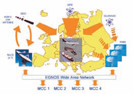
The current GPS civil service provides suitable performance only in situations of good electromagnetic visibility; the positioning becomes difficult in severely signal degraded environments, e.g. mountainous or urban areas, where a lot of GPS signals are blocked by buildings or
natural obstacles. The GPS gaps can be partially solved employing spacebased augmentations systems; in this paper we consider geostationary and geosynchronous constellations. A simulation software has been developed in MATLAB® environment in order to study the integration of existent and feasible constellations.


 (5.00 out of 5)