Articles in the Imaging Category

ISRO and JAXA gear up for joint Chandrayaan-5
During May 13-14, 2025, ISRO, India and JAXA, the space agency of Japan, jointly conducted the third face-to-face Technical Interface Meeting (TIM-3), towards the Chandrayaan-5/LUPEX mission, in ISRO Headquarters, Bengaluru. The meeting was attended by senior officials, project executives, and technical team members from ISRO, JAXA, and …
Rocket Lab launches private Japanese ‘Strix’ satellite
Rocket Lab launched an Earthobserving radar satellite for the Japanese company Synspective on March 20. An Electron rocket topped with one of Synspective’s Strix satellites lifted off from Rocket Lab’s New Zealand site on Friday at 2:10 p.m. EDT (1810 GMT; 7:10 a.m. on March 21 local New …
China launches Yaogan satellite
China conducted a pair of launches sending a second Yaogan-50 satellite into a highly retrograde orbit and completing a Kuaizhou-11 solid rocket rideshare mission. A Long March 6A rocket lifted off at 8:22 a.m. Eastern (1322 UTC) March 15 from Taiyuan Satellite Launch Center …
White-label CAD solution in Japan
Pythagoras BV and Terra Drone have formed a strategic partnership to introduce a customized white-label software solution for the Japanese market. It combines Terra Drone’s SLAM and UAV technologies with Pythagoras’ CAD and point cloud processing software, creating an integrated platform tailored …
SpaceX launches next-generation Italian COSMO-SkyMed satellite
The third satellite part of the COSMOSkyMed Second Generation (CSG) constellation, owned by the Italian Space Agency and the Italian Ministry of Defense, built by Thales Alenia Space, a joint venture between Thales (67%) and Leonardo (33%) and operated in orbit by Telespazio, a joint venture between Leonardo (67%) …
UAVOS partners to advance HAPS technology
UAVOS has announced the successful completion of a test flight of Mira Aerospace’s High-Altitude PseudoSatellite (HAPS) ApusNeo 18, with UAVOS providing full engineering and technical support. One of the key objectives of the flight was to evaluate the jointly developed optoelectronic, gyro-stabilized aircraft POD (Payload Onboard Device) by obtaining …

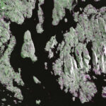
The findings of this study show the potential of using UAS-lidar as a sampling tool for estimating and monitoring AGB and other forest structural attributes.
Hastings Shamaoma
Department of Urban and Regional Planning, Copperbelt University, 21692 Kitwe, Zambia.
Paxie W. Chirwa
Forest Science Postgraduate Programme, Department of Plant and Soil Sciences, University of Pretoria, Private Bag X20, Hatfield, Pretoria …
Iran prepares first Chabahar space launch
Iran plan to launch three Earth-observation satellites and carry out the first test launch from its new Chabahar space center, signaling a further expansion of its space program amid Western concerns over the dual-use nature of Iranian rocket technology. The Zafar-2, Paya and the second batch of Kosar imaging satellites …
NASA-ISRO satellite sends first radar images of earth’s surface
The NISAR (NASA-ISRO Synthetic Aperture Radar) Earth-observing radar satellite’s first images of our planet’s surface are in, and they offer a glimpse of things to come as the joint mission between NASA and ISRO (Indian Space Research Organisation) approaches full science operations later this year. Images from …
NOAA flood mapping now covers 60% of U.S.
NOAA’s National Weather Service (NWS) announced its experimental Flood Inundation Mapping (FIM) tool. The FIM provides near-real-time, high resolution, street-level visualizations of f lood waters to assist NWS forecasters in issuing flood watches and warnings. It helps provide …


 (5.00 out of 5)