
Articles in the Issue Category

Volume XVIII, Issue 10, October 2022
Cadastre forensics, para surveyor and mobile app for land registration
Trias Aditya
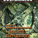
The Antikythera Mechanism: Discerning its role in ancient navigation
James E. (Jim) Wyse
Integrated UAV photogrammetry and automatic feature extraction for cadastral mapping
Oluibukun Gbenga Ajayi and Emmanuel Oruma
My Coordinates
EDITORIAL
His Coordinates
Kiyokazu Minami and Takeyasu Sakai
News
GIS | GNSS | LBS …
Volume XVIII, Issue 9, September 2022
DEM delivers better approximate AHD heights on public record
Jonathon Smith and Volker Janssen
Generalized orthogonalization an elegant solution to the least squares problem
Joël van Cranenbroeck
My Coordinates
EDITORIAL
His Coordinates
Kym Osley , Hesham M Helal , John Johnson-Allen , Jirí Svaton
News
GIS | IMAGING | LBS | UAV | INDUSTRY
CALENDAR
Ocotober 2022 – June …

Volume XVIII, Issue 8, August 2022
Laser scanning in archaeology and cultural heritage documentation
Hina Pande, Poonam Seth Tiwari
and Shefali Agarwal
NRTK observations and their uncertainties in a modern datum
Tom Bernstein and Volker Janssen
New insights into large tropical tree mass and structure from direct harvest and terrestrial lidar
Andrew Burt, Matheus Boni Vicari, Antonio C L da Costa, …

Volume XVIII, Issue 7, July 2022
EN16803 European geolocation standard to certify mobility solutions
Xavier Leblan, Giuseppe Rotondo, Miguel Ortiz and Christelle Dulery
Logistics tracking system based on decentralized IoT and blockchain platform
Marouane El Midaoui, El Mehdi Ben Laoula, Mohamed Qbadou and Khalifa Mansouri
Analysis of factors affecting industrial site selection in Hawassa town, Ethiopia
Muluneh Beyene Tsala
My Coordinates
EDITORIAL
News
INDUSTRY | …
Volume XVIII, Issue 6, June 2022
Scientific project for monitoring of geodynamic processes in Sofia
Nikolay Dimitrov
Spatial analysis of soil trace element contaminants in urban public open space
Andrew W Rate
Mapping physical development changes using Geospatial techniques
Leonard Michael Onyinyechi Aminigbo
My Coordinates
EDITORIAL
News
INDUSTRY | GNSS | GIS | LBS | IMAGING | UAV | GEODESY
CALENDAR
July 2022 – November 2022
Advertisers in …
Volume XVIII, Issue 5, May 2022
Local Moho estimation using gravity inversion
H M I Prasanna
Evaluation of KSACORS-based network GNSS-INS integrated system for Saudi coastal hydrographic surveys
Mohammed El-Diasty
Mapping the urban atmospheric carbon stock
MD Abdul Mueed Choudhury, Ernesto Marcheggiani, Andrea Galli, Giuseppe Modica and Ben Somers
Is India’s forest cover really increasing? Official maps don’t tell you the whole …

Volume XVIII, Issue 4, April 2022
LiDAR in oil palm disease detection
Nur Azuan bin Husin and Siti Khairunniza Bejo
Spatial and economic inequities and trends in South Africa
Sue Bannister, Michael Sutcliffe and Willy Govender
Mapping the urban atmospheric carbon stock
MD Abdul Mueed Choudhury, Ernesto Marcheggiani, Andrea Galli, Giuseppe Modica and Ben Somers
My Coordinates
EDITORIAL
News
INDUSTRY | GNSS | GIS …
Volume XVIII, Issue 3, March 2022
Aviation prepares to reorientate
David Learmount
Package of approved revised ITU-R Recommendations on RNSS systems
Review of Continuously Operating Reference Stations activities in India
Subhalakshmi Krishnamoorthy
Spatial analytics for a resilient and low carbon urban India
A K Jain
Digital Twin: A Promising and futuristic integrated technology for digital transformation
Komal S Pawar
My Coordinates
EDITORIAL
News
INDUSTRY | GNSS | …

Volume XVIII, Issue 2, February 2022
A new C++ programming course in action at Moscow University of Geodesy and Cartography
V R Zablotskii
Cryptographic digital technology for the prevention of property theft
Jethro Jones
Emerging IoT paradigm – A technology perspective
Patrick Marv Casiano
A new kind of city science built on living structure and on the third view of …

Volume XVIII, Issue 1, January 2022
Let the Metaverse v/s Omniverse race begin!
Graeme Hooper
Technology trend in 3D mapping systems for mining
Giorgio Vassena
5 ways drones are improving workplace safety standards
James Rennie
High-accuracy augmented positioning services will become the new normal
Guy Buesnel
Geo-spatial big data analysis of Covid-19 spectrum envelope of first and second wave of the outbreak in …


 (5.00 out of 5)