Articles in the Issue Category

Volume XIX, Issue 7, July 2023
Applying Malawi Continuously Operating Reference Stations in GNSS Meteorology
Robert Galatiya Suya, Charles Chisha Kapachika, Mphatso Oscar Soko, John Bosco Ogwang, Harvey Chilembwe and Francis Gitau
A proof of Concept of the integration of blockchain with an ISO 19152:2012 based Land Administration System
Attoumane Tahar, Gervais Mendy and Samuel Ouya
GIS in facility …

Volume XIX, Issue 6, June 2023
Surveying in Nigeria: Academic and Professional challenges
Godwill Tamunobiekiri Pepple, Emilia Biobele West, Precious Lenyie and Amarachi Oteyi
How prepared is Delhi for a 7 intensity earthquake?
A K Jain
GIS mobile application for crime reporting and monitoring
D Duffour, C Y Asante and A A Acheampong
My Coordinates
EDITORIAL
News
GIS | …
Volume XIX, Issue 5, May 2023
Development of GNSS software for Ghana Survey and Mapping Division
Gameti Charles, Acheampong Akwasi Afrifa, John Ayer
Energy transition in Nigeria: A technological and philosophical perspective
Mike Iroh
My Coordinates
EDITORIAL
His Coordinates
Jesse Huff
News
GIS | GNSS | IMAGING |
AUTONOMOUS DRIVING | INDUSTRY …
Volume XIX, Issue 4, April 2023
National Geospatial Policy, 2022: An urban perspective
Dr Mahavir and Dr Prabh Bedi
Protecting GNSS against intentional interference
Arul Elango, Ahmed Al-Tahmeesschi, Mikko Saukkoriipi, Titti Malmivirta and Laura Ruotsalainen
Dual-Frequency EGNOS and Galileo-based GNSS Receiver and Antenna for Railway: TRENI Project
Marco Puccitelli, Chiara Manno, Livio Marradi, Gaetano …
Volume XIX, Issue 3, March 2023
gLAB: an advanced GNSS software for research and pedagogical purposes
Adrià Rovira-Garcia, Deimos
Ibáñez-Segura, Mowen Li, María Teresa Alonso, Jaume Sanz, José Miguel Juan and Guillermo González-Casado
Determination of a GNSS-based velocity field of the African continent
Saturday E. Usifoh, Benjamin Männel, Pierre Sakic,
Joseph D. Dodo and Harald Schuh
MAGICA project: Crossed IFA Multi-frequency GNSS Integrated …
Volume XIX, Issue 2, February 2023
Generation of high resolution geospatial data using airborne topographic LiDAR and digital camera
data
B Sadasiva Rao, G Varaprasad Babu, B Laxman, P Srinivasulu, S Muralikrishnan, R S Mahendra, P C Mohanty, Ch Patanjali Kumar and T Srinivasa Kumar
Employee location tracking in retail stores
Caner Guney, Emre Tuncel and Hakan Ulagan
Performance assessment …

Volume XIX, Issue 1, January 2023
The Convergence of 5G, high precision data delivery and AI
Arn Hayden and Brandon Sights
Evolving GNSS Spectrum Situational Awareness / RADAR Technologies
Graeme Hooper
Precise positioning techniques will continue to grow
Andy Proctor
Survey of leisure walking behaviours and activity tracking use
James Williams, James Pinchin, Adrian Hazzard and Gary Priestnall
Urban informatics …
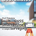
Volume XVIII, Issue 12, December 2022
Positioning performance evaluation of a dual frequency multi-GNSS smartphone
TILL WEIGERT AND GUENTHER RETSCHER
Use only horizontal ground distance [not grid distance] dimensions in land surveys
JOHN READ
Animal navigation: how animals use environmental factors to find their way
ROSWITHA WILTSCHKO AND WOLFGANG WILTSCHKO
My Coordinates
EDITORIAL
News
GNSS | GIS | IMAGING | UAV | LBS| INDUSTRY
CALENDAR
February 2023 …

Volume XVIII, Issue 11, November 2022
Assessment of the completion of the forest cadastre considering the legal grounds, collaboration, and the use of technology
Orhan Ercan and Nur Kemalettin Toker
On the applicability of integrated UAV
photogrammetry and automatic feature extraction for cadastral mapping
Oluibukun Gbenga Ajayi and Emmanuel Oruma
Animal navigation: how animals use environmental factors to find their way
Roswitha …
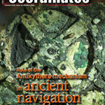
Volume XVIII, Issue 10, October 2022
Cadastre forensics, para surveyor and mobile app for land registration
Trias Aditya
The Antikythera Mechanism: Discerning its role in ancient navigation
James E. (Jim) Wyse
Integrated UAV photogrammetry and automatic feature extraction for cadastral mapping
Oluibukun Gbenga Ajayi and Emmanuel Oruma
My Coordinates
EDITORIAL
His Coordinates
Kiyokazu Minami and Takeyasu Sakai
News
GIS | GNSS | LBS …


 (5.00 out of 5)