Articles in the Issue Category

Survey and GIS: Finding the missing links Gary A Jeffress, Bruce Carlson, Gary R Kent, Matthew Smith, TN Wong
Galileo E5 signal acquisition strategies Nagaraj C Shivaramaiah, Andrew G Dempster
The way we walk
Alexandra Millonig
Fuzzy logic approach for sustainable land use planning
Novaline Jacob and Krishnan R

Synchronet – an innovative system
Franco Gottifredi, Monica Gotta, Enrico Varriale, Daniele Cretoni
High Resolution Satellite Imagery (HRSI) replace Aerial Photography?
Shunji Murai
Role of Photogrammetry and Remote Sensing in Wenchuan Earthquake
Deren Li
3D mapping from space?
Prof Dr Armin Gruen, Dr Kirsten Wolff
My experience with GPS licensing
Manvendra
Solving the GPS gap
Antonio Angrisano, Armando Pacifico, Mario Vultaggio
Government policy, applied research, commercialization…
Dr. Robert A. Ryerson, Chanchai Peanvijarnpong
VLBI geodetic precision with different models
Erhu WEI, Jingnan LIU, Peijing PAN
Going deeper undergroundl
Marc Hobell, Jim Stancliffe
The potential of cell-based positioning for improving LBS
Markus Ray
Active RFID trilateration for indoor positioning
Guenther Retscher, Qing Fu
Evolution of GPS Navigation in India
Amit Prasad
Simulation of Galileo E5 Signal
Fantinato Samuele
GIS for lymphatic filariasis morbidity management and control
M Palaniyandi
Volume IV, Issue 3, March 2008
Zip
Mapping errors
Dr Beena Chintalapuri, V Raghu Venkataraman
A real-time GPS/INS integrated system
Yong Li, Peter Mumford, Chris Rizos
Science of Interoperability
David Schell, Dr D R F Taylor
Google exposed!
Sampling the world
Rainer Mautz
GPS antenna: from relative to absolute
Aristidis Fotiou, Christos Pikridas, Miltiadis Chatzinikos
My Coordinates
EDITORIAL
News
INDUSTRY …
GATE: A boon for Galileo
Dr. Guenter Heinrichs, Erwi n Loehnert, Elmar Wittmann, Roland Kaniuth
GAGAN Updates
Arjun Singh
Through a scanner, darkly
John Kelly
Galileo is necessary
Dominique Detain
Japan: Augmenting navigation
Akio Yasuda
Inspiring’ INSPIRE
Ian Masser
Estimates of Anomalies in Triangular Area between GPS stations
Sridevi Jade, Saigeetha A J, Vijayan M S M
A strategic approach to data sharing
Mansour Ahmadi Foroushani
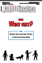
Volume VI, Issue 7, July 2010
Zip
GNS What next?
F Michael Swi ek, Miguel Angel Martínez Olagüe, Bruce Peetz, Keith D McDonald, Bernhard Richter, Ir. Hans Viss er, John Pottle, Thom as Seiler, Sang Jeong Lee
Tsunami three years down the line
Prem Shanker Goel, Prof Tad S Murty, Rehabiliation and reconstruction bo ard, Indo …
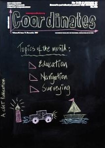
Volume III, Issue 11, November 2007
Zip
GNSS education in Asia Pacific: Miles to go
Azmi Hassan, Mustafa Din Subari
Precision Agriculture
Abdul Rashid Mohamed Shariff, Ebrahim Jahanshiri
Breaking distance barriers
Shunji Murai
India-Pakistan maritime boundary: Issues and approach
Rear Admiral K R Srinivasan
What is Extended Particle Filter?
Priyanka Aggarwal, Naser El-Sheimy
My Coordinates
EDITORIAL
His Coordinates
DATO’ DR ABDUL KADIR BIN TAIB
News
INDUSTRY | LBS | …





 (5.00 out of 5)