| His Coordinates, Interviews | |
“We have the ability to tie the IMU and GNSS measurement data together”
|
|||||||||
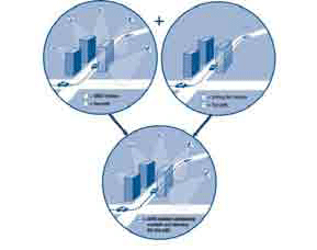
“NovAtel’s SPAN technology supplements GPS, opening doors for various applications requiring precise positioning”.Please explain. NovAtel has long been known for precision GPS and GLONASS technology. NovAtel’s GNSS lineup stretches from single frequency GPS-only functionality all the way up to dual-frequency, GPS/GLONASS, RTK and L-band capable receivers. All GNSS systems have the same limitation; to solve a solution they require reception of a very weak signal from a satellite orbiting 20,000km above us. In situations when the satellite signals are blocked by things like buildings or heavy foliage, the GNSS solution can become unreliable. When precise positioning is required in GNSS-obstructed environments, GNSS needs to be augmented in some way. One option is to pair the GNSS with an inertial measurement unit (IMU) to form a GNSSINS system. This is what NovAtel does in our Synchronized Position Attitude and Navigation (SPAN) product. IMUs come in many shapes, sizes and grades. The base components of an IMU are gyroscopes that measure rotation and accelerometers that measure acceleration. Integrating rotation and acceleration over time gives a very stable relative position, velocity and attitude. In SPAN, NovAtel’s OEMV receiver is paired with one of a range of IMUs from various suppliers and of differing grades to enable our customers to operate in nearly any environment. The one thing that immediately stands out about SPAN technology is its capability even when GNS reception is restricted. Please explain how?When the two navigation technologies, GNSS and INS are brought together, they each bring their individual strengths into the product. GNSS provides accurate position and velocity when at least 4 satellites are in view. However, when not in view, the GNSS solution degrades almost immediately. The INS provides the attitude of the vehicle, roll, pitch and heading, and stable relative position over time without requiring external inputs. However, when the IMU navigates on its own, errors from the gyros and accelerometers accumulate over time and introduce errors in the solution. When GNSS signals are present, SPAN uses the GNSS data to calibrate the error sources from the IMU. When the GNSS signals become unreliable or completely obstructed, SPAN uses the calibrated INS to bridge through the gap and maintain an accurate position, velocity and attitude solution. How does this technology deliver ‘faster’ GNS signal reacquisition?Because NovAtel’s core technology is precision GNSS, we have the ability to tie the IMU and GNSS measurement data together at a very low level in SPAN. By doing this we can optimize the strengths of both the GNSS and the IMU. Two good examples of how SPAN takes advantage of this architecture are: GNSS Carrier Phase Observations: SPAN utilizes the accurate carrier phase observations from our OEMV serial receivers directly in the GNSS/ INS solution. The benefit of using the measurements instead of just the GNSS position solution is that the mmaccurate observations can be used even when there are not enough satellites in view to compute a full GNSS position solution. This result is an improvement in position solution accuracy of up to 50% in difficult GNSS conditions. GNSS Tracking Loop Aiding: Because the GNSS/INS SPAN solution is generated right on the receiver, SPAN has direct access to the GNSS tracking loops. We can use the inertial data to help the tracking loops find the satellites faster when the vehicle moves out from under an obstruction. Satellite reacquisition time is reduced to under 2 seconds. This means that in very difficult satellites tracking situations, like urban canyons, the receiver can track all available GNSS signals which in turn provide the best calibration possible of IMU error sources. What applications do you think can benefit most from the SPAN technology?There are a wide range of applications for SPAN. The application areas break down into two groups: those that require the attitude of their vehicle and those that require robust positioning in difficult GNSS conditions. An application that SPAN is particularly well adapted to is ground-based mapping and imagery collection. The deeply-coupled architecture of SPAN enables users to get a robust solution in even the most built-up of areas. The optimal use of all GNSS observation data and IMU measurements results in precise positioning and attitude determination in locations where GNSS typically gives erratic results. Further to these traditional GPS/INS markets, SPAN has been used very successfully for television broadcast enhancements, for autonomous airborne refuelling, and in many other innovative, unique market applications. What is the role of the ‘Inertial Explorer’ software?
In post-processing, the constraints of real-time operation are eliminated, so the software can process the data forwards and reverse in time and also combine and smooth forwards and reverse solutions to greatly reduce the errors associated with the IMU sensors and limited GNSS availability. Applications that do not require a real-time solution can improve their final solution greatly by using Inertial Explorer features like AdVance RTK GNSS carrier phase positioning and base-station free Precise Point Positioning using downloadable precision satellite clock and orbit information. How cost effective is the technology to implement?SPAN technology is available in a range of configurations. There are several IMU options to choose from depending on your accuracy requirements, budget and geographical location. The deeply coupled architecture of SPAN and Inertial Explorer provides performance levels that have typically required much more costly systems. The optimal combination of the GNSS and IMU data in SPAN enable lower grade IMU options to perform almost identically to higher-grade IMU systems. The latest addition to the SPAN lineup is the SPAN-CPT, which combines NovAtel’s OEMV technology with fiberoptic gyros and MEMS accelerometers in one housing. Export headaches sometimes experienced with inertial technology are alleviated with SPANCPT as the system is comprised entirely of commercial components. |
|||||||||


 (No Ratings Yet)


