| LBS | |
Watch your steps!
|
||||||||
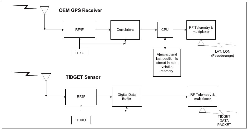
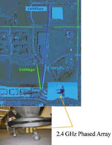
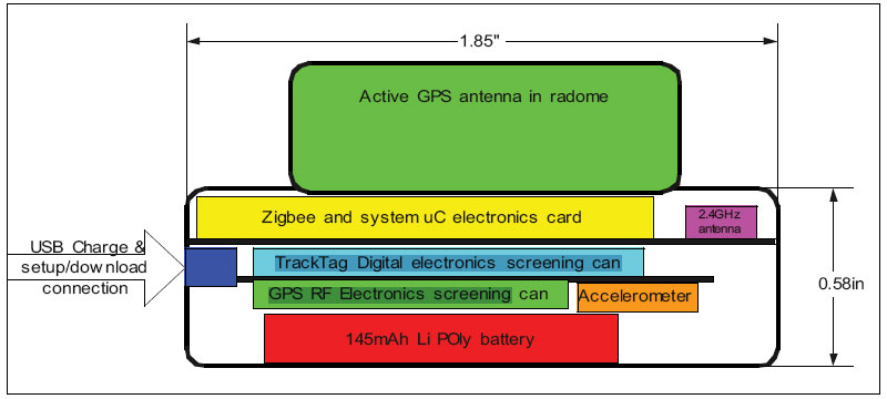
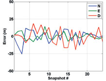
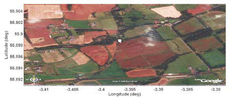
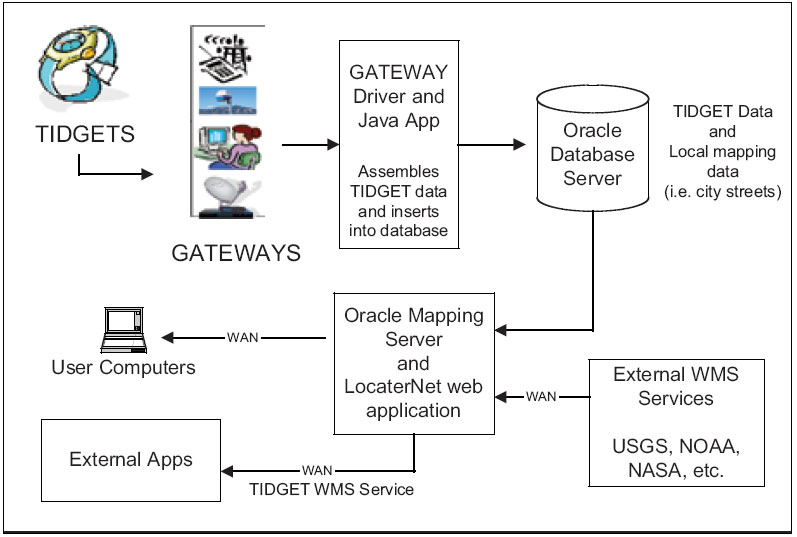
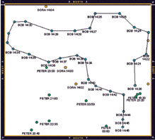
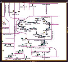
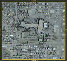
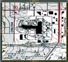
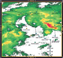
TIDGET/ZigBee GPS sensorThe patented TIDGET® (“tracking widget”) sensor operates by taking brief snapshots of GPS data when activated [1]. These snapshots are stored in the flash memory and forwarded to the LocatorNet Server through the data link for processing [2]. The TIDGET is built using the RF front-end of a commercial GPS chip (see Figure 2). The device is designed to operate with a variety of different types of data links providing a low-power location solution. Instead of performing the GPS signal processing using an internal baseband processor, the TIDGET device only samples and records the GPS snapshots periodically. While this requires more data to be transmitted across the wireless data link, it significantly reduces the overall power drain of the device making this an ideal solution for low-power tracking applications. The TIDGET can be programmed to take different sizes of GPS snapshots depending on the application. The larger the snapshot, the greater the ability of the LocatorNet processing to track low-power GPS satellite signals [3]. For the TIDGET/ ZigBee device, a 36.4 kbyte snapshot size was selected. This allows GPS signals to be detected to a C/N0 of 26 dB-Hz (-148 dBm) with an SNR detection threshold of 10 dB. When multiple satellites are in view, enhanced signal processing can be used to detect weak signals as low as 20 dB below the strongest GPS satellite signal, down to a threshold of -156 dBm. The TIDGET/ZigBee wristwatch device includes a ZigBee data link that can be used to connect to a ZigBee Gateway when within range. ZigBee[3] is a lowpower wireless mesh networking protocol that has been designed for maximum power life. A networking protocol has been developed that allows the ZigBee wireless data link to transport the data to the Gateway where it is forwarded to the TIDGET/ZigBee Server for processing. The normal range of operation of the ZigBee data link, using onboard or PCB antennas, is within 100 feet of a Gateway. A Gateway can be a conventional PC equipped with a ZigBee USB device and installed with the LocatorNet network upload software. While straight ZigBee dongles exist, the system design uses a TIDGET/ZigBee unit configured in a “gateway mode” connected by USB to the PC. The LocatorNet network upload software converts the TIDGET/ZigBee data into a sequence of database update commands and sends those over a TCP/ IP connection to the Portal. The range between the TIDGET/ZigBee device and the ZigBee Gateway can be extended by adding an improved antenna to the ZigBee Gateway. Static directional antennas on both the node and the coordinator can improve the operational distance by a factor of 4-10, but are unacceptable for the watch unit. Larger amplified directional antennas, such as that shown in Figure 4, have allowed us to extend the highbandwidth single-hop transmissions up to 765m, while only using the onboard PCB antenna for the TIDGET/ZigBee node The Phased Array antenna shown in Figure 4 also provides a Linux-based network router making it ideal for a Gateway unit. As depicted in Figure 4, the TIDGET/ ZigBee wristwatch unit comprises a ZigBee chip with an embedded microcontroller, a “glue-logic” CPLD programmable logic device, GPS cache SRAM, bulk-storage Flash memory, a GPS front-end RF chip, antenna and TCXO, a USB interface chip and power management circuitry. Each captured GPS snapshot requires 15mJ to acquire Figure 2 TIDGET Sensor under all circumstances. To transmit the data to the Gateway, the circuit will consume between 70mJ and 231mJ per snapshot depending on range and signal environment. Total battery energy available to the device is 2000 Joule. Locatornet portalThe LocatorNet Portal is based on an Oracle Application Server. The ZigBee Gateway software is designed to “publish” data into the LocatorNet Portal which initiates a data processing sequence using the LocatorNet Server signal processing software. The LocatorNet Server GPS processing is implemented Figure 3 Extended Range ZigBee Connection Figure 4 Wristwatch TIDGET/ZigBee Component using an SDR architecture where the GPS signal generation and code correlation functions are performed in software. The GPS Navigation data is loaded into the LocatorNet Portal from reference station sites across the Internet allowing worldwide tracking of GPS data. The LocatorNet Portal also can access digital terrain data allowing altitude-aided solutions to be Figure 5 Snapshot NED Comparison to Reference calculated in the event that only three GPS satellites are tracked. Figure 5 and Figure 6 illustrate the navigation accuracy provided a CEP of 5.14 m. As shown in Figure 7, the LocatorNet Portal also supports Location Based Services (LBS) based on the TIDGET solution data using an Oracle Mapping Server with an open architecture Open Geospatial Consortium (OGC)5 compliant web service based design approach. OGC have developed a family of web services that can be used for sharing and distributing mapping and feature data between web servers. This includes Web Mapping Service (WMS), Web Feature Service (WFS) and OpenGIS® Location Service (OpenLS). A variety of different WMS data feeds are already available on the web from public sources and more are being added. Examples of some of the data that has been linked into the LocatorNet Portal are shown in Figure 8 through Figure 12. Figure 8 shows current TIDGET Figure 6 Snapshot Position Solution Figure 7 LocatorNet LBS Architecture data for a user’s area of interest that has been extracted from the local LocatorNet database. In Figure 9 the user adds in vector street data to provide location context. This street data is stored on the server database, and thus is available even when the server is not able to access the Internet – useful for some mobile and military applications. In Figure 10 the user has requested a USGS supplied topographic map overlay in lieu of the vector streets. This data was requested on-the-fly from the USGS through the Internet [6]. Figure 11 shows a highresolution aerial image obtained from another USGS Web Map Service as the background [7]. Lastly, Figure 12 shows how remote data services can also provide time-sensitive information – in this case Doppler radar data [8]. |
||||||||
Alison Brown & Peter K. Brown
|
||||||||||||||||||
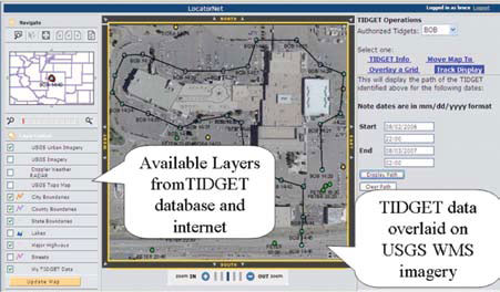
Example locatornet applicationFigure 13 illustrates a basic LocatorNet personnel tracking LBS application. This application was developed based on an Oracle Application Server and iSMART5 mapping server, together with some custom web pages. The Oracle Application Server and database maintains data integrity and security, allowing users access to only the data they need. Oracle Spatial database extensions were used to quickly provide spatial querying capabilities; users can ask questions such as “Who is near the intersection of Powers Blvd and 30th Street,” or “Where was User X at 2pm yesterday?” By making use of live WMS feeds such as Doppler radar users can even make queries such as “Was User X being rained on a 2 pm yesterday?” The flexible LocatorNet LBS architecture allows additional mapping and feature content to be easily added for customized applications. Maps, images, and features from WMS, WFS, and WCS sources can easily be added into location based services. The open architecture also allows content to be shared through OpenLS standards. ConclusionThe TIDGET/ZigBee tracking sensors have the following advantages over previous GPS tracking solutions. • Ultra low-power design enabling operation for 30 days using a wristwatch size device and battery • Wireless networked connectivity using low-cost COTS ZigBee devices • Improved ZigBee data transfer reliability using an enhanced ZigBee transmission protocol The open architecture, standard-based design approach for the LocatorNet server has the following advantages for offering Location-based services • Web-based access and display of the TIDGET/ZigBee tracking results using only a thin client • Powerful search and query engines using Oracle’s geospatial application server • Rich feature content through integration with Open GIS web services • Flexible web based user interface Figure 8 TIDGET/ZigBee Data Figure 9 City Streets overlay from local database Figure 10 Combining a topographic map pulled over the internet from a USGS Web Map Service Figure 11 High-resolution Aerial Imagery pulled over the internet from another USGS Web Map Service Figure 12 Live Doppler radar pulled over the internet from a NOAA Web Map Service design for rapid implementation and deployment of web based services • Secure data management for maintaining privacy and managing access to TIDGET/ ZigBee tracking data A variety of commercial and military applications exist for the TIDGET/ZigBee tracking unit and the LocatorNet Locationbased services. The first TIDGET/ZigBee system is being developed for the U.S. Army TATRC for use in clinical trials. Its initial use is envisioned as a hospital type bracelet that will be used to collect the location and time of treatment applied to trauma patients in support of clinical trials. Other applications for the TIDGET include embedding in other wireless devices which require low power operation and location operation, such as 3G cell phones, or for geotagging sensor data or images, for example in digital cameras. NAVSYS is currently working with industry partners who are interested in producing and distributing the TIDGET devices for a variety of commercial applications. Figure 13 LocatorNet Application AcknowledgmentsThe authors would like to acknowledge the support of Dr. Gary Gilbert and TATRC who have provided funding to support the development of this technology. References[1] A. Brown, “The TIDGET – A Low Cost GPS Sensor for Tracking Applications,” ION 5th International Technical Meeting, Albuquerque, September 1992 [2] GPS tracking system, United States Patent 5,379,224 [3] A. Brown, M. May, B. Tanju, “Benefits of Software GPS Receivers for Enhanced Signal Processing,” GPS Solutions 4(1), Summer, 2000 pp 56-66 [4] ZigBee Specification v1.0, ZigBee Document 053473r00, Version 1.00, ZigBee Alliance dated December 14, 2004. [5] Open Geospatial Consortium, http://www.opengeospatial.org/ [6] Via http://terraserver-usa.com/ [7] Via http://terraserver-usa.com [8] http://maps.customweather.com/ image?VERSION=1.1.1&REQUE ST=GetCapabilities&Service=WMS |
||||||||||||||||||
|
||||||||||||||||||
|
Pages: 1 2




 (No Ratings Yet)


Leave your response!