NEWSBRIEFS – GIS
Jan 2008 | Comments Off on NEWSBRIEFS – GIS
|
|
|
|
|
|
|
 |
|
|
Mapping center of israel to launch Geography portal
The Mapping Center of Israel (MAPI) will soon launch a new national geography portal. The new site will have 120 information levels about land, outline plans, maps, trips, sites, aerial images, and historical maps. The maps on the site were created through collaboration with various ministries and will be free. www.globes.co.il |
|
|
Indonesian health department to deploy GIS
Cadcorp, business partner in Indonesia, Transavia Informatika Pratama, (TIP), has been awarded a significant contract by the Indonesian Department of Health. It will supply a number of licences of Cadcorp SIS Map Modeller and Map Editor desktop GIS software to the Directorate of Community Health of the Indonesian Department of Health. It will also develop applications based on Map Modeller and Map Editor for use in mapping and analysing the distribution of health facilities and outbreaks of disease. www.cadcorp.com |
|
|
|
Satellite imagery and GIS helps powerGrid (India) to avoid forests
State-owned power transmission utility Power Grid Corp. of India Ltd (PGCIL) has started using satellite imaging and the GIS technology to avoid taking its transmission lines through forest cover. Currently, only 2% of the transmission firm’s lines run through forests, down from 6% eight years ago. www.livemint.com |
|
|
Nepal-India border mapping continuing
According to Ministry of Foreign Affairs in Nepal the scientific mapping of the Nepal-India boundary is underway on the basis of historic agreements and international law and principles since 1981. The joint technical teams from Nepal and India have just completed the scientific strip mapping of about 98 per cent of the Nepal-India border over the last several years. Both www.gorkhapatra. org.np/content.php?nid=33138 |
|
|
Traffic GIS for India by Mapunity

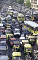
By harnessing telecom data provided by Airtel, its enterprise partner, Mapunity can apply the solution to ease urban traffic at a less cost. Bangalore was the first city in India to get its own traffic information system (TIS) in June this year on GIS platform by the company followed by Hyderabad and Chennai and Delhi shall be soon. The project allows cellphones to act as proxies for its users, whether they are on foot or in vehicles. The number of cellphones carrying Airtel’s SIM cards gets logged in Airtel’s towers which then denote the traffic movement. www.rediff.com |
|
|
DSSDI Project
Survey of India, and Government of Delhi joined their hands together and launched Delhi State Spatial Data Infrastructure (DSSDI) project. The project is an outcome of a pilot project by Department of Science and Technology, government of India on 3D GIS in Chandni Chowk area in Delhi in collaboration with Russian Academy of Sciences. As a part of the project a monitoring room was established to receive images from 10 cameras placed at vantage points to do the change detection on real time. According to Government of Delhi, the 3D database is immensely useful for various applications and it should immediately be created for entire NCT of Delhi and should be completed well before Common Wealth Games -2010. The project will cover a total area of NCT Delhi of approximately 1500 Sq. km. |
|
|
|
|


 (5.00 out of 5)


 (5.00 out of 5)


 (5.00 out of 5)


 (5.00 out of 5)