| My News | |
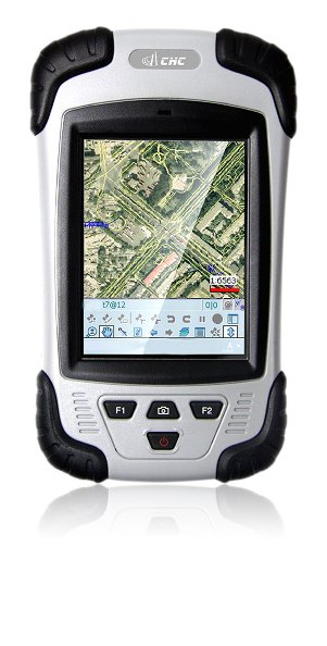
CHC releases the LT30 GPS/GIS handheld collector
 2 April 2012 – CHC’s new LT30 series enters the GIS data collection market with a cost-effective, rugged and connected GPS/GIS handheld collector for a wide range of applications such as natural resources, forestry, utilities, agriculture, emergency response…
Designed for real outdoor conditions, LT30 combines superb brightness and crisp 3.7″ full VGA sunlight readable display, all day battery life and a high-sensitivity 20-channel GPS receiver to capture data wherever you need.
Powered by Windows™ Mobile 6.1 Pro operating system, the LT30 offers seamless compatibility with 3rd party mobile GIS software such as ESRI’s ArcGIS™ for Mobile and ArcPad™ applications. The LT30 GPS/GIS is a multi-functional solution including built-in GPRS phone and data transmission, Bluetooth and Wi-Fi connectivity, 3.2 megapixel camera with autofocus and a versatile RS232 interface to connect to legacy devices.
“Our LT30 is the perfect choice for GIS and Survey professionals eager to invest in powerful yet affordable GPS/GIS handheld computer,” says George Zhao, CEO of CHC. “The LT30 includes all the features needed for today and future applications. No hidden options or costly upgrades later on.”
The LT30 is now available through CHC’s distribution channel worldwide.


 (No Ratings Yet)


Leave your response!