Articles in the GNSS Category

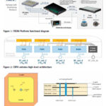
This paper presents the TRENI railway GNSS receiver and antenna development, to be used directly or integrated in a train multi-sensor safe positioning platform, suitable for railway safety-related applications
Marco Puccitelli
Thales Alenia Space Italia., Via E. Mattei 1, 20064 Gorgonzola (Milan), Italy
Chiara Manno
Thales Alenia Space Italia., Via E. Mattei 1, 20064 Gorgonzola (Milan), Italy
Livio Marradi
Thales Alenia …

This paper offers a state-of-the-art review of several proposed methods for interference detection and mitigation with solutions ranging from traditional to machine learning-based approaches.
Arul Elango
Department of Computer Science, University of Helsinki, Finland
Ahmed Al-Tahmeesschi
Department of Computer Science, University of Helsinki, Finland
Mikko Saukkoriipi
Department of Computer Science, University of Helsinki, Finland
Titti Malmivirta
Department of Computer Science, University of Helsinki, …

The present paper shows the prototype results of the antenna designed in the scope of the MAGICA project providing a multi-constellation and multi-band (L1/E1, L5/E5 and E6) solution for the automotive industry
Marco Antonio Vélez
IDNEO Technologies, S.A.U, Carrer Rec de Dalt, 3, 08100 Mollet del Vallès (Barcelona), Spain
Jose Javier Vicente
IDNEO Technologies, S.A.U, Carrer Rec de Dalt, …

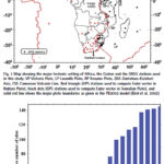
This study provides for the entire continent of Africa the position/ velocity solution precisely expressed with reference frame IGSR3
Saturday E Usifoh
GFZ German Research Centre for Geosciences, Potsdam, Germany Institut für Geodäsie und Geoinformationstechnik Technische Universität, Berlin, Germany Centre for Geodesy and Geodynamics, Toro, Bauchi State, Nigeria
Benjamin Männel
GFZ German Research Centre for Geosciences, Potsdam, Germany
Pierre Sakic
GFZ …

We give an example of a straight forward procedure tailored to understand and question the effects of different error components in both SIS domain and the position domain
Adrià Rovira-Garcia
Research group of Astronomy and Geomatics, Universitat Politècnica de Catalunya, Spain Corresponding author: Universitat Politecnica de Catalunya, Spain, adria.rovira@upc.edu
Deimos Ibáñez-Segura
Research group of Astronomy and Geomatics, Universitat Politècnica …

GNSS-based onboard orbit determination can now reach a similar performance as the DORIS (Doppler Orbitography and Radiopositioning Integrated by Satellite) navigation system. It lends itself as a viable alternative for future remote sensing missions
Oliver Montenbruck
Deutsches Zentrum für Luft‑ und Raumfahrt (DLR), German Space Operations Center, 82234 Wessling, Germany
Florian Kunzi
Deutsches Zentrum für Luft‑ und Raumfahrt (DLR), …

The EN16803 series of standards is designed to help users make better choices and simplify the integration of satellite technologies into onboard systems
Xavier Leblan
GUIDE-GNSS, Toulouse, France
Giuseppe ROTONDO
GUIDE-GNSS, Toulouse, France
Miguel Ortiz
Université Gustave Eiffel, Nantes, France
Christelle Dulery
CNES (French Space Agency), Toulouse, France
Abstract
The geolocation field has acquired a reference methodology that is essential for evaluating and characterizing …

This paper gives an overview of the activities related to CORS being carried out by various entities in India.
Subhalakshmi Krishnamoorthy
Deputy Director [Retd], ISRO Telemetry Tracking and Command Network, Indian Space Research Organisation, Bangalore
Abstract
Continuously Operating Reference Stations (CORS) is a network of stations that provide global navigation satellite system data consisting of carrier phase and …

A number of challenges lie ahead when it comes to developing international standards for resilience
Guy Buesnel
PNT Security Technologist, Spirent
How the world became dependent on GNSS for PNT
The arrival of GPS kick-started a revolution. Using GPS was a cheap and reliable method of obtaining precise time and accurate position fixes globally. This revolution really accelerated when …
The Department of Space, Government of India has the primary responsibility of promoting the development of space science, technology and applications towards achieving self-reliance and facilitating in all round development of the nation. The report narrates all the major activities of the department including navigation, earth observation and Gaganyaan
Department Of Space (DOS), Government of India …


 (5.00 out of 5)