| GNSS | |
LCNSS is better than GNSS
|
||||
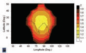
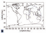
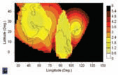
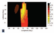
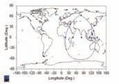
Demand for Satellite Navigation technology and applications keeps on increasing in a wide range of economical, social, technological and environmental sectors. This growing interest in the development of Satellite Navigation Systems is demonstrated by the interest of several countries in starting the development of new systems or contributing to existing ones. The major rational behind is: • Increase the performance of current systems, and or provide new services • Ensure independence and availability of the systemsA high number of satellites is required for providing acceptable performances. GNSS systems are expensive to develop, maintain and operate. The modernisation of GPS is on going, but it is progressing slowly. The GLONASS constellation is not completely operational and is still far away from reaching the required level of performances. Galileo was started in 1999, but the In Orbit Validation Phase has not yet being completed. These facts are demonstrating the complexity associated to the deployment and operation of a GNSS. GNSS do not only require a significant number of satellites in orbit but also a rather complex ground infrastructure (orbitography and integrity stations, uplink stations, control centres, etc.) worldwide distributed. The cost of a GNSS is limiting the capability of Figure 1: Constellation over India (6 satellites) Figure 2: Constellation over India (6 satellites) HDOP, 5º masking angle Figure 3: Constellation over India (7 satellites) some countries or regions to develop their own systems. Consequently those countries need to deploy their own augmentation systems and establish agreements with other states. This situation may change if the development of Low Cost Navigation Satellite Systems (LCNSS) became a reality.LCNSS are designed to optimise performances over the area of interest while trying to minimise the overall costs. Acceptable performances (comparable to those provided by GPS today) can be obtained with a few satellites (5 to 10) and a reduced ground segment, as there is no need to deploy Ground Stations worldwide but only over the coverage and neighbour areas.Independence and autonomy are key concepts to be considered in the LCNSS design. However, the possibility of interoperation with other systems is a very important added value: • LCNSS combined with SBAS: LCNSS are in principle not aimed at providing integrity or safety critical services. If required, they would be able to be provided by complementing the LCNSS by using Satellite Based Augmentation Systems. • LCNSS combined with GNSS: LCNSS will be able to provide supplementary means for improving the performances of current GNSS systems. In particular the orbit determination and time synchronisation processes are improvable and the integrity concepts are susceptible of simplification. • LCNSS combined with LCNSS: The addition of several LCNSS could give way to a GNSS, leading to excellent navigation performances over relatively large areas. • International cooperation would be promoted by sharing the same frequencies and with the same characteristics with the ones used by the already existing systems. GEIO satellites: A viable solution for LCNSS constellations designFigure 4: Constellation over India (7 satellites) HDOP, 20º masking angle Figure 5: Constellation over India (7 satellites) HDOP, 5º masking angle, 99.9% availability level Figure 6: Constellation over India (8 satellites) Figure 7: Constellation over India (8 satellites) HDOP, 30º masking angle Regional LCNSS are viable using constellations of satellites in Geosynchronous Eccentric and Inclined orbits (GEIO), either by themselves or in combination with satellites in geostationary orbits.The use of GEIO constellations is believed to be the best alternative, since these constellations allow focusing on a particular region, while the eccentricity and inclination can be optimised in order to provide the best performances over the required area. Once the region of interest has been selected, the next step is to find the optimum constellation to provide the best navigation performances over that region. Optimum constellation means maximising the navigation performances while keeping the system associated costs as low as possible.Polaris is a state-of-the-art tool aimed at assessing the user navigation performances at the application level. A constellation design module, which supports the design of low cost, highly efficient navigation and communication constellations, is integrated in Polaris. This module has been extensively used for optimizing Galileo constellations, and for performing the analyses presented in this paper. |
||||
Pages: 1 2




 (1 votes, average: 3.00 out of 5)


Leave your response!