| Conference | |
A much needed initiative
|
||
| NEGeo 2006 has happened. It was historic, encouraging and incredible. istoric as never before has a conference of this scale, importance and success taken place in the region. Encouraging, as stakeholders from all states were present and participated actively. Incredible because of the enthusiasm and spirit of participation that was displayed by the attendees.
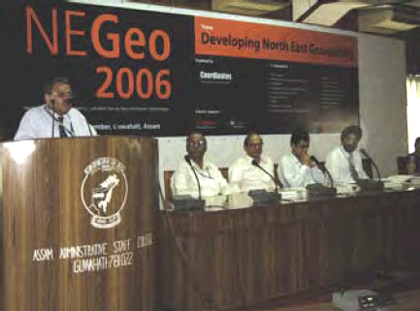
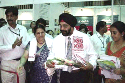
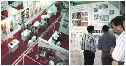
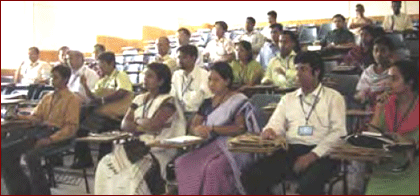
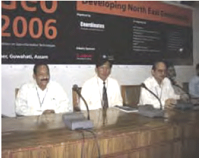
The success of conferences cannot be judged only by the number of participants but also by the technical inputs that arise during relevant debates. The objective of NEGeo 2006 was to understand and identify the developmental issues and needs of the North East region and explore the role of geo-information technologies. It envisaged to increase awareness levels and act as a platform to assimilate various initiatives being taken by different states. In this conext, NEGeo is a significant step. It has a triggered a process and that’s where the success of NEGeo lies.In his keynote address, Brig CS Bewli, Deputy Surveyor General, Survey of India highlighted the challenges related to mapping and surveying in North East Region. While addressing the gathering of over 200 participants, he emphasized that although the region is economically underdeveloped, it is rich in natural resources and as such, Geo-Informatic technology should be used for planning and developmental purposes in the NE region. The inaugural session was addressed by Prof Gautam Barua, Director, IIT Guwahati; Brig RC Padhi; Military Survey, Indian Army, Dr KC Bhattacharya, Director, NESAC; Dr Vandana Sharma, Senior Technical Director, NIC; and Prof SC Patra, Director, NERIWALM. The NEGeo 2006 conference held at Assam Administrative Staff College, Guwahati from Sept 21- 22 was organized by Centre for Geo-Information Technologies (cGIT), publisher of Coordinates magazine. The conference was coorganised by IIT Guwahati, National Informatics Centre, NERIWALM, Department of Science & Technology, Survey of India, NESAC, Guwahati University, NEHU, Planning Commission, ISRO etc. During NEGeo 2006, Department of Science and Technology orgainzed a session on NE SDI and NERWALM organized a session on Land and Water Resource Management. Some of the key speakers were Brig B Nagarajan, Survey of India; Dr G Chennaiah, Director SRSAC, Arunachal Pradesh; Prof Dulal Goswami, Guwahati University; Dr RP Singh, Census of India; Prof BS Mipun, NEHU; Dr Zavei Hiess, Director; Nagaland Science and Technology Council; and Dr TG Antony Balan, Chairman Brahmaputra Board etc. More than 25 presentations were made during the conference. A three-day residential training program was also organised on 18-20 Sep at IIT Guwahati. The programme was attended by around 30 participants. ExhibitionAdditionally, an exhibition was also organized during the conference which was participated by the Survey of India, NERIWALM, NE Space Application Centre, National Informatics Centre, Forest Survey of India, Census of India, Canon, Lepton Software, Aerial Services, AMIL Ltd, CADD Centre, Elcome Technologies, PCI Software, IDS, ERDAS India and many more players from the industry. NEGeo 2006 communique
In a two-day conference attended by more than two hundred delegates, academia, industry, and various government departments deliberated on several key issues pertaining to the growth of geomatics in the NE region. NEGeo 2006 understands the need of spatial data in the region for developmental purposes. Although some data is available pertaining to NE region with national agencies and a few organizations in the region, it is not in standardized format, thus restricting utility value for the lowest level of governance like village councils, village development boards, gram panchayats, municipalities and traditional and tribal institutions. There is no system for data acquisition, updation or dissemination. These issues are discussed in the first of its kind conference NEGeo 2206. The release of National Map Policy last year in May and the adoption of NSDI resolution this year in June by the Government of India is a very positive step in creating the spatial data infrastructure to be used by one and all in case planning and development. Specific policy framework/guidelines under the overall national policy relevant to North East region is the need of the hour. The presentations by the Survey of India and NIC indicated that they are coming forward with much more openness to share and provide data e.g. digital toposheets at Rs 5,500 (1:50,000 scale) and NIC through their network freely. Updating maps of 1:10,000 scale and the rationalization of the projection system are welcome steps. We will welcome a time frame for the NE region for such updated maps. The initiative taken by the DST on NESDI was appreciated in a session devoted to NESDI and the vision was endorsed by the delegates. The DST, being a forward looking organisation, should take the lead and establish the NESDI under NEC which is an apt body under the Government of India, with mandate for planning and development. The methodology and the results of work conducted in different states of NER has formed a base to prepare the strategy for NESDI and standardize the formats and procedures.There is a need for institutional mechanism for NESDI and resolution other related issues. The approval of Secretary, NEC to establish NESDI is welcome. A core group may be formed to continuously work and provide the necessary inputs for establishing and functioning of NESDI. The creation of a digital data base involves technology inputs. Sophisticated instruments and software are essential and expensive requirements; many who are interested in getting involved in digital data creation, often cannot afford to. Hassle free functioning and maintenance and other technical support is an added bottleneck. The non-availability of high-resolution satellite data from NRSA to academic institutions hinders research activities in this region. The NEGeo recommends resolving such issues on priority. NEGeo 2006 emphasised the need of trained technical man power for efficient implementation of geoinformation technologies in the region. A well thought-out capacity building programme with networking of resource institutions may be planned. Enhancing the training facilities in the region to quickly meet emerging requirements is also recommended. There is a need for more collaboration among the various government and non-government organisations working the field of geo-information technologies in NE region. NEC may act as a nodal agency for this. The presentations made at NEGeo 2006 have led to the conclusion that digital data will have to be created for all kinds of digital data projects. This should be encouraged by the funding agencies, implementation agencies, state governments and district administration, which can be implemented in a phased manner. Ministry of Science and Technology should enhance funding for digital data creation and technology development, on one hand and other ministries such as Ministry of IT, DONER, Ministry of Water Resources, Ministry of Agriculture, Ministry of Rural Development, Ministry of Environment and Forests, Ministry of Urban affairs, Ministry of Surface Transport etc should earmark funds for such activities in NER in their programmes. Planning Commission may also formulate special programmes for NER to create digital data base. It was also recommended that NEGeo should be held annually . The recommendations are discussed at NEGeo 2006 and endorsed by the gathering. |
||


 (No Ratings Yet)


