| Imaging | |
Imaging
DIGIPIN launched
IIT Hyderabad (IITH), in partnership with the Department of Posts and the National Remote Sensing Centre, ISRO, has launched DIGIPIN—a compact, human-readable, geospatial addressing system set to redefine how India navigates, delivers, and connects.
DIGIPIN offers a precise, intuitive, and inclusive code that represents the exact latitude and longitude of any location in India, from dense cityscapes to isolated maritime regions. Built as a digital public infrastructure layer, it aims to streamline postal operations, emergency responses, e-commerce delivery, and public services.
Notably, DIGIPIN maintains privacy, containing no personal identifiers and requiring only location-enabled devices to retrieve codes. Its machine-readability allows applications such as printing barcodes on consignments, integrating with digital wallets, and use in high-priority zones like disaster relief and public utility mapping. pragativadi.com
ISRO hands over 10 advanced technologies to Indian firms
The Indian Space Research Organisation (ISRO) has transferred ten of its start-of-the-art technologies to six Indian industries across the upstream, midstream, and downstream segments. The tripartite Technology Transfer Agreements (TTAs), facilitated by the National Space Promotion and Authorisation Centre (IN-SPACe), were signed between NewSpace India Limited (NSIL), the recipient industries, and IN-SPACe.
Among the technologies transferred are two advanced inertial sensors—the Laser Gyroscope and the Ceramic Servo Accelerometer—developed by ISRO’s Inertial Systems Unit, for potential use in satellite launch vehicles. These technologies have been transferred to Zetatek Technologies Pvt. Ltd., Hyderabad.
In the midstream segment, three technologies related to ground station operations—S/X/Ka tri-band dual circular polarised monopulse feed, tri-axis antenna control servo system, and Ku/C/L and S Band Cassegrain feed—developed by ISRO have been transferred to Avantel and Jisnu Communications, both Hyderabad-based firms.
On the downstream front, two geospatial models developed by SAC/ ISRO for pest forewarning and semi-physical crop yield estimation were transferred to Amnex Info Technologies, Ahmedabad, for deployment in agricultural decision-making and crop protection.
A compact, multi-parameter, portable bathymetry system developed by NRSC/ISRO has been transferred to Jalkruti Water Solutions Pvt. Ltd., Ahmedabad, to enable UAV based integration for water resource monitoring.
Further, VSSC/ISRO’s ceramic-based flame-proof coating technology—initially developed for launch vehicle applications— has been acquired by Ramdev Chemicals, Ahmedabad, for wider industrial applications. www.fortuneindia.com
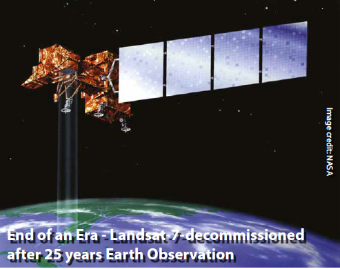
End of an Era – Landsat-7-decommissioned after 25 years Earth Observation
After 25 years of capturing Earth’s changing landscape, the Landsat 7 satellite received its final transmission from the U.S. Geological Survey and was officially decommissioned June 4, closing a remarkable chapter in space-based observation.
While Landsat 7’s long watch over Earth comes to an end, Landsat 8, launched in 2013, and Landsat 9, launched in 2020, continue to work together to create a complete snapshot of Earth every eight days. Their successor—Landsat Next—is currently planned to launch in the early 2030s and provide even greater coverage and detail.
Launched in 1999 as a joint mission of the USGS and NASA, Landsat 7 significantly enhanced Earth observations and provided a key part of the Landsat program’s f ive decade-plus record of imaging the planet’s surface. The satellite’s imagery will remain archived at the USGS Earth Resources Observation and Science Center, continuing to support scientific discovery and decision-making for the future.
“The Landsat satellites have delivered over 50 years of extraordinary science data, economic value and national security benefits by informing decisions in every sector of the economy—from monitoring drought in the West to guiding disaster recovery,” said Sarah Ryker, USGS Acting Director. “For 25 of those years, Landsat 7’s data helped farmers, land managers, city planners, and scientists, as well as communities around the world better understand and manage land, water, and other natural resources.”
Landsat 7 achieved many milestones over its 25 years of operation and was the first Landsat to downlink data to the newly established USGS ground station in Sioux Falls, South Dakota. It was also the first Landsat satellite to be fully operated 24/7 by the USGS after being launched by NASA.
Its Enhanced Thematic Mapper Plus sensor delivered improved high-resolution imagery that expanded its capabilities, capturing critical historical events such as the aftermath of 9/11, Hurricane Katrina, and the Deepwater Horizon oil spill. The satellite also contributed to important projects, including the Landsat Image Mosaic of Antarctica, and inspired the “Earth As Art” collection, showcasing stunning visuals of the planet.
After ending its official mission in 2024, the USGS prepared Landsat 7 for decommissioning to follow responsible space practices and U.S. policies on keeping space clear of debris. The final steps included carefully lowering the satellite’s orbit to decrease the risk of collisions and ensuring that all energy sources, such as fuel and batteries, are depleted to prevent the satellite from accidentally turning back on or creating debris. As Landsat 7 begins this decommissioned phase, it will drift silently in orbit for about 55 years before reentering Earth’s atmosphere. www.usgs.gov


 (No Ratings Yet)


Leave your response!