| Mapping | |
Information quality – A critical success factor
The Swedish approach to Property Information 2025, has an objective that information quality can meet the requirements from both the society in general, for the built environment as well as to secure the rights for property owners |
 |
|
Historical review of property information in Sweden
Sweden has a long tradition in registration of land. We therefore have long experience in the field of real properties and how to handle the information. However, the fact that we have been doing this for so many years is not just an advantage. The transformation and changes that have been made over the years also entails a legacy that complicates the work with the information.
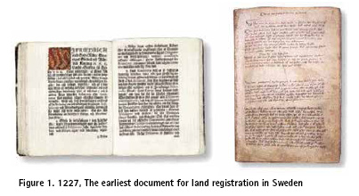
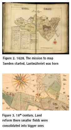
To get a glimpse of where we stand today, the following is a very brief description of what has happened over the centuries until today. It all started as far back as the 13th century and the way of registration has changed, for understandable reasons, many times over the centuries. The oldest document about land transfer is from the year of 1227. In 1628 on April 4, The King of Sweden, Gustaf II Adolf gave the instruction to Anders Bure to conduct a systematic survey of the country. The main objective of the work was to describe the country’s property boundaries, geography and who owned the properties. This information would be the basis for raising taxes and developing society, but also for making political decisions in crisis situations. The maps also showed farms, villages, towns, factories, ports and mines.
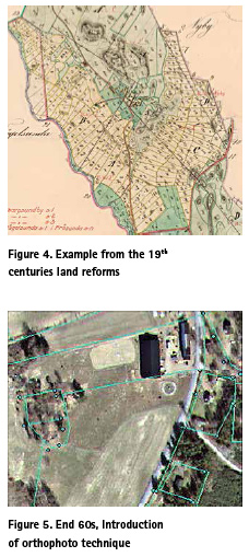
In the 18th century Sweden had a big land reform where plotty small fields were consolidated into fewer and larger ones, with the aim of achieving more efficient farming. In the 19th century Sweden started several land reforms to optimize the land use further which continued until the middle of the 20th century.
In 1935 Sweden introduced the aerial photo technique to improve the map coverage. A map in the scale of 1:10 000 was created which was based on cadastral survey maps.
In the end of the 60s we introduced orthophoto technique which contributed to the improvement of quality.
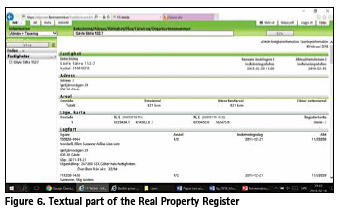
In 1968 a governmental authority was created to build a computerized textual system for registration of all real property information in the country. The task of transferring the information from cadastre and land register books continued until 1995 when the whole of Sweden had been entered in the Real Property Register.
In 1992 a work to create a National digital map data base started where the land use map (1:10 000) were used as foundation. To get the information maps were scanned or digitized manually. After the two data capture activities were completed we had two digital records, one textual and one vector based that was visualized in the cadastral map. That is the Real Property register that we use today in Sweden.
From signal system towards decision-making systems
When the data capture for the Real Property Register was completed, the register could, inter alia, be used as a basis for the handling of property transfers. The fact that Lantmäteriet had a map part and a text part that did not always match was not so important at the beginning as the registry was mostly used in Lantmäteriet’s own activities where additional information from acts etc. was available. For those who used the information outside Lantmäteriet, the map was used to get an overview of the properties, but to find out the exact location, markings were used on the ground or Lantmäteriet was contacted.
As information, nowadays has begun to be used more and more in other activities than in real property development in Sweden, the requirements have increased as to the quality of the information in the register.
In the community and in the governmental world there is a transformation going on. The activities range from working on a paper-based workload with digital elements to a completely digital management, where the entire decisionmaking processes takes place digitally.
The Real Property Register in Sweden has good faith and reputation, which is positive, but it also leads to the fact that everyone does not know that the information in the registry has to be handled correctly in order to make the right decision. Many believe that everything in the registry is correct just because it is stored digitally.
Examples of the changing demands that society today has on the information
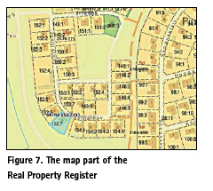
The property boundaries in the map were collected by scanning or digitized from old map substrates of varying quality, which resulted in a lot of errors in the registry at the time of collection. With today’s GPS technology, it is very easy to insert coordinates that a forestry machine can use in connection with harvesting. There are currently examples in the forestry industry, using the Lantmäteriet map to set these coordinates, which can be very wrong.
In Sweden today, there is a high demand on new developments for housing but the planning and building process often can take a long time. By digitizing the whole process where different authorities interact with each other, the time it takes for someone to build housing until the residence is in place can be reduced. However, this puts great demands on the quality of the information in order to use the information in an uninterrupted digital flow and to make correct decisions.
Lantmäteriet has for a number of years had a long-term goal of increasing and widening the use of information that we provide. In that area we have succeeded very well, information today is used much more than before.
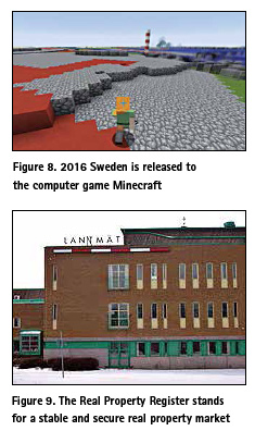
Two years ago Lantmäteriet released maps over Sweden for the computer game Minecraft. The intention was to expose the information in a simple and small playful way to get media interest around the area of open data. It got a very large exposure in the media where schools, individuals etc. built new worlds with Sweden’s map data as the basis. After the release of Minecraft, there has been a lot of interest in the information that Lantmäteriet provides without saying that the maps that were released to Minecraft contributed entirely to this. But for each new user of our information, the requirements for getting correct information are increased.
Technological developments have made it easier to create services, applications and apps for our mobile phones, which means that the use of information has increased drastically.
There are many more examples of where fast and accurate information is needed to make quick decisions that have not been listed in this brief description above. This is just a summary description to get a picture of the challenges we are dealing with today.
Let us try to summarize the examples above, what has happened in the last decade?
The need from society and those who use the information has gone from being a signal system where the need before was to get overall information to decision-making systems where the need today is to get fast and accurate information that can be used in a digital uninterrupted flow of information.
Property Information 2025
As described above, society’s requirements have recently changed because it now works to digitize and automate processes. The demands are constantly increasing and everyone strive to get a more cost-effective business.
But what do we do to improve the quality of the information we store in the register? The answer is that we do many things, but before we go into them, a description is given below of how we value the information we have in our records.
The information is our greatest asset
It is the good quality of the information that helped us in Sweden over the years to have, and still have, a stable and secure real property market. In the Real Property Register it is the dossier that is legally valid which decisions is based on. You can feel safe in Sweden in terms of ownership. The stable real property market helps society to continue to evolve, where the properties often stand as collateral for borrowing money from credit institutions.
It is therefore easy to make a comparison with the banks regarding the information. If we do not care for the information entered in the register, the interest rate and the return on the stored information (insured capital) will be low. The total value of the information would therefore decrease in the long run unless the information is constantly maintained and improved.
Another example from Sweden taken from another business is the tracks that the trains run on, where the maintenance has suffered for a long period of time. For several years it worked quite well but eventually the tracks and the traffic volume reached a limit where maintenance needed to be performed. Then major disruptions have occurred in traffic and the maintenance that now started will be done at very high costs.
The return on invested capital generally exceeds the cost involved, and especially in the information area. Therefore, we consider the information as our greatest asset!
Activities in order to raise quality of the property information by 2025
After the property information was digitized, we have been constantly working to improve and enhance the quality of the information we have in the register. This has been done as a continuous improvement work with targeted efforts to raise the quality of the register. However, a large part of the work performed has been a reactive work carried out when errors have been detected in the register.
Since 2006 we have been working on quality development projects aimed at improving the quality of the register. During these years, we have invested quite large sums every year. Despite the cost we think we have contributed to a clear improvement in the register well worth the effort put down. Now it is time to take the next step in this work to better meet the needs of society for the information stored in the Real Property Register.
We have set long-term goals regarding information quality and made a plan for how we will work to achieve these goals. Some of these goals can be seen as quite forward thinking where we by 2025 may not have fully achieved them. It is important to aim high where great benefits for society can be given if we succeed in this work.
The long-term goals we will be working on are as follows:
▪ The quality of the Real Property Register is described.
▪ The property information is uniform across the country.
▪ Property boundaries have such a quality that they can meet important society and user needs.
▪ The presentation of contractual rights, official rights and joint facilities is complete.
▪ The introduction of new real property information needed for the development of society as well as the discontinuation of information that no longer needs to be kept in the register.
▪ Other property-related information needed for the development of society and a clear division of responsibility between Lantmäteriet and other information-based authorities. Lantmäteriet are responsible for linking the property information.
▪ The information transferred to the Real Property Register is correct (Data from processing Cadastral procedures, property transfers etc.)
▪ Text and geometry in the real property register is managed as a cohesive object with the ability to manage 3D.
▪ There is awareness among users about how to use the property information properly.
Under each goal there are a lot of activities that all aim to reach as close as possible to the achievement we have planned for until the year 2025. It will not be easy but we will work hard to be there.
How to make it all great
How, then, do we work in a structured way to make the Real Property Register ready for the demands that society now puts on us and what is the secret to accomplishing this? Here is an overall description of how we work in Sweden to improve the quality of our information.
Property Information 2025, as described above, is the long-term plan for quality work with the information in the Real Property Register. On a short-term basis we have 1-year plans for the activities we will do to improve the quality of the registry during the year. We also have a quality improvement project that we work with on a long-term basis in which we have 3-year plans.
An expression we usually use in Sweden is “Together, we are strong.” This also applies to the planning for and implementation of measures in the register. The experts on the details are usually the ones who work operatively in the business.
By giving the experts space to grow and taking their own initiatives within the given limits innovative and good suggestions on how to work with the challenges increases. We follow up the plans but we do so with moderation.
An additional success factor for delivering valuable benefits in quality development work is to have clarity regarding roles and responsibilities. In Sweden, we have “information owners” who are the ones responsible for the information we store in the register. It is also the information owners who decide which quality measures will be performed in the register during the year. The information owner decides the quality development plan and follows up the progress of the plans.
Errors discovered in the daily life is handled immediately. An assessment is made if an action needs to be carried out directly or if the rectification can be planned in the structured work being carried out on a regular basis. A change that is made in the register is always logged and documented. The tool Jira is used today for multiple information layers for the handling of errors detected to digitally handle documentation that is not logged directly in the system.
At the moment, discussions have begun in the area of crowdsourcing to improve the quality of the register. It is a change from today when Lantmäteriet does everything by ourselves. However, it is important that that kind of collections complies with current legislation in the area.
Ensure quality through measurements
In order to ensure that the quality is improved, in recent years we have worked a lot with measurements of the existing quality. In that work, we carry out a number of measurements to check that the targeted quality efforts provide improvements in the registry. We also measure the existing quality to ensure that no new information stored is incorrect or inadequate.
The parameters we measure are:
▪ New registered data from Cadastral procedures and property transfers
▪ The actuality of the map
▪ Information quality overall
However, it is a big challenge to develop the measurements and to find measurements that best describe how the quality of the information really are. But It is worth the effort cause the information quality increases with help from the measurements. For example, when it comes to proactive measures, such as when you want to minimize new errors the measurements are helpful.
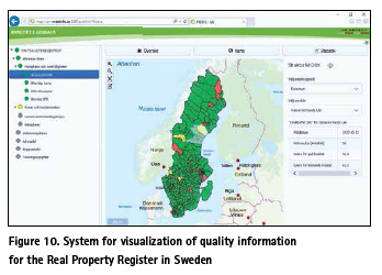
In autumn 2017, we developed an internal system to visualize the quality of the information, which will be implemented shortly. In this application, those who work with information, information owners, decision makers and other stakeholders can easily see how the situation is with a specific information layer. The system will be further developed, and what have been developed up to now will work as a basis for continued work.
Suggestions
This was just a bit of overall information about the background and work done in Sweden to work with and improve the quality of the real property information.
Finally, here are some tips and suggestions to succeed in improving the quality of the information stored:
▪ Think long-term, set up challenging goals / visions.
▪ Plan, but not just for the sake of the plans. Make sure something is happening too.
▪ Define roles and responsibilities for the work with the information
▪ Look at the information as one of our greatest assets where value increases when we make investments in quality.
▪ See it as positive that the information is used but also count on getting help from users when it comes to finding errors.
▪ Working with the quality of information takes time.
▪ Do measurements to improve and describe the quality.
▪ Be transparent to those who use the information. Better to say that the quality is poor than anyone believing that the information is completely correct.
▪ Work together to find constant improvements
▪ Work in a structured way, plan for both reactive and proactive measures that need to be undertaken.
▪ Have fun!
Lastly, what’s at all worth doing is worth doing well!
References
www.lantmäteriet.se The biography of Lantmäteriet The paper was presented at FIG Congress, 2018, 6-11 May 2018, Istanbul, Turkey


 (No Ratings Yet)


Leave your response!