Articles tagged with: D. R. Fraser Taylor

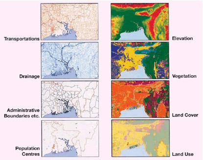
THE United Nations Conference on Environment and in Rio de Janeiro recognized the need to coordinate environmental data and spatial information as an aid to decision making in formulating responses to the challenges of global environmental change and to support sustainable development. The concept of Global Map as a means of doing this was introduced by the Government of Japan and became a formal part of the Agenda 21 action plan. Global Map is a digital map of the world at the scale of 1:1 million which is produced by a cooperative effort of the national mapping organizations of the world. At the time of writing (May 2007) 172 countries and regions were involved in the creation of Global Map. Global Map has eight data layers, four in vector format and four in raster format. These are transportation, boundaries, drainage, population centres (in vector format) and elevation, vegetation, land cover and land use (in raster format).


 (5.00 out of 5)