NASA-ISRO satellite sends first radar images of earth’s surface
The NISAR (NASA-ISRO Synthetic Aperture Radar) Earth-observing radar satellite’s first images of our planet’s surface are in, and they offer a glimpse of things to come as the joint mission between NASA and ISRO (Indian Space Research Organisation) approaches full science operations later this year. Images from the spacecraft, which was launched by ISRO on July 30, display the level of detail with which NISAR scans Earth to provide unique, actionable information to decision makers in a diverse range of areas.

On Aug. 21, the satellite’s L-band synthetic aperture radar (SAR) system, which was provided by NASA’s Jet Propulsion Laboratory in Southern California, captured Mount Desert Island on the Maine coast. Dark areas represent water, while green areas are forest, and magenta areas are hard or regular surfaces, such as bare ground and buildings. The L-band radar system can resolve objects as small as 15 feet (5 meters), enabling the image to display narrow waterways cutting across the island, as well as the islets dotting the waters around it. Then, on Aug. 23, the L-band SAR captured data of a portion of northeastern North Dakota straddling Grand Forks and Walsh counties. The image shows forests and wetlands on the banks of the Forest River passing through the center of the frame from west to east and farmland to the north and south. www.nasa.gov/ news-release/nasa-isro-satellite-sends first-radar-images-of-earths-surface. |
Taiwan dispatches remote sensing satellites to US
Taiwan shipped the first satellite of its next-generation FORMOSAT-8 Earth-observation program to the US on Tuesday for a planned fourth quarter launch, according to the Taiwan Space Agency (TASA). Officials hailed the send-off as a milestone for Taiwan’s space ambitions. The spacecraft has been dubbed the “Chi Po-lin Satellite,” honoring the late aerial filmmaker whose documentary “Seeing Taiwan” raised public focus on the island’s environment. The launch will begin deployment of an eight-satellite constellation designed to provide frequent imaging of Taiwan and the wider region. The remaining units are expected to roll out over several years, with full deployment targeted by 2031. www.aa.com.tr
UAE-France cooperation
The Emirati National Space Science and Technology Center (NSSTC) and U-Space, a French smallsat constellation manufacturer, signed a major contract for the design and manufacture of a turnkey 12U satellite. It will be the precursor of a future constellation dedicated to the Emirati LEONAV programme, which aims at deploying a Low Earth Orbit, Positioning, Navigation and Timing (LEO PNT) service. This contract is a major milestone for the NSSTC to demonstrate the delivery of a LEO PNT service in the area. www.u-space.fr
New Iranian satellite set for launch
Hossein Shahrabi, CEO of a knowledge-based company that has manufactured the satellite, told Tasnim that it has been designed as a follow-up to Kowsar and Hodhod satellites, incorporating the combined missions of both. He explained that Dual-View 1 is designed to function as Iran’s first integrated remote sensing and communications satellite within a planned constellation.
The upgraded model features additional solar cells and improved communications hardware. From the three communications links used in Kowsar and Hodhod, the most effective have been integrated into the new satellite, along with the addition of an S-band link, enabling full ground-based attitude control programming, he added. Shahrabi said Dual-View 1 is scheduled for launch in the Iranian month of Azar (November 22 – December 21) with the same launcher previously used for Kowsar and Hodhod. https://en.mehrnews.com
UK rail network to be monitored from space
SatSense has secured a landmark multi-million-pound, multi-year contract with Network Rail to deliver network-wide ground deformation monitoring, flood mapping and change detection services using satellite radar technology. This is the first time globally that integration of satellite-based ground monitoring has been undertaken at this scale by a major rail operator. The innovative approach paves the way for redefining geotechnical asset management and setting a new standard for sustainable infrastructure monitoring.
Under the agreement, SatSense will deliver processed InSAR data and derived services that integrate into Network Rail’s earthwork asset management systems, utilizing data from satellites such as the Sentinel-1, NISAR and TerraSAR-X constellations. The approach aims to enable a transition to reduce reliance on repeat on-site examinations which can be costly, subjective and untimely. satsense.com
Australian nanosatellite snaps 1st selfie
The first image taken by the SpIRIT selfie camera, acquired over New Zealand at the end of the thermal radiator deployment sequence. (Image credit: University of Melbourne (Australian University)
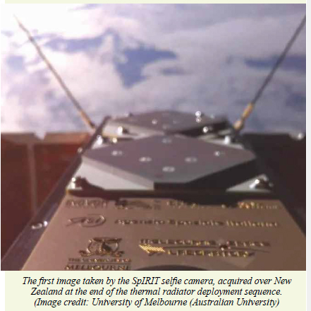
Australia’s SpIRIT nanosatellite has snapped its first “selfie” from space, marking a successful start to its mission.
SpIRIT — formally known as the Space Industry Responsive Intelligent Thermal nanosatellite — is the first space telescope funded by the Australian Space Agency to carry a foreign space agency’s scientific instrument as its main payload.
Launched in December 2023 aboard a SpaceX Falcon 9 rocket, SpIRIT has now completed its commissioning phase, testing all its onboard systems, including its winged thermal management and deployable camera arm, which it used to take a “selfie” in space.
Recent images shared by the University of Melbourne show the satellite in orbit, confirming that its systems were deployed and are functioning correctly. The images include snapshots of the satellite’s thermal radiator, electric propulsion thruster payload, telecommunication transceivers and solar panels. www.space.com |
JAXA choses ArkEdge Space to study LEO PNT system
ArkEdge Space Inc., a Japanese space startup based in has been selected by the Japan Aerospace Exploration Agency (JAXA) to conduct the “Study of Key Technologies and Related Systems for the Dedicated Low Earth Orbit Positioning, Navigation, and Timing (LEO-PNT) system.” The LEO-PNT system will comprise a constellation of small satellites in low Earth orbit (500–1,200 km), significantly closer to Earth than conventional GNSS which orbit at approximately 20,000 km. Operating at lower altitudes is expected to enable the delivery of high intensity and higher-accuracy positioning information services globally.
LEO-PNT’s high-intensity positioning signals are expected to complement the weak signal strength of conventional GNSS signals reaching the Earth’s surface, which are more susceptible to interference. With threats such as jamming and spoofing becoming increasingly prominent, the more accurate and reliable positioning information provided by LEO-PNT is also expected to be used in many other fields.
This study builds on JAXA’s Feasibility Study on LEO-PNT (Part 1) conducted from October 2024 to March 2025. The new effort will further advance research into key technologies and system concepts required to establish a robust, GNSS independent alternative PNT capability.
The study will particularly focus on designing resilient PNT architectures capable of maintaining operations even when GNSS is disrupted. It will also address the design and transmission of robust LEO-PNT signals, including both ranging signals and navigation messages, across multiple frequency bands such as the C-band (C1: 5010 5030 MHz, C2–4: 5030–5250 MHz), S-band, and L-band. arkedgespace.com |


 (No Ratings Yet)


Leave your response!