NEWSBRIEFS – GPS
Oct 2008 | Comments Off on NEWSBRIEFS – GPS
|
|
|
|
|
|
|
 |
|
|
Govt Approves Modern Navigation Project GAGAN
In a bid to provide seamless navigation over the Indian airspace and waters, the Indian government has approved the implementation of a Rs 774-crore GPS aided futuristic project. The GPS aided Geo Augmented Navigation (GAGAN) project would place India in a select group of nations, like the US, Europe and Japan, to possess such a system that would not only guide aircraft over its airspace, but also provide them straight-line fuel-efficient routes and precision approach landings.
The Cabinet Committee on Economic Affairs approved the implementation of this project which is being developed jointly by the Indian Space Research Organisation and the Airports Authority of India. The GAGAN system would provide coverage of oceanic areas, which is not possible by the terrestrial systems that are in place now.
It would also improve airport and airspace access in all-weather conditions and provide precision-landing approaches to aircraft even at airports, where Instrument Landing Systems do not exist. Press Trust of India |
|
|
Satellite navigation assists workers at remote sites
CSIRO’s Minerals Down Under National Research Flagship says it is working with various stakeholders to develop two new navigation technologies for remote areas.
The GNSS technologies include an integrated receiver and a transponder. The receiver takes signals from several satellite constellations and other inputs. The transponder works with the receiver to automatically communicate the location of the user. This will allow companies with assets and people at remote sites to better manage their safety, traffic and efficiency. The enhanced workforce management systems will also increase security for workers located in remote areas. The Queensland Government is supporting the project through a $333,000 grant provided under its $300m Smart State Innovation Funding Program. CSIRO has also partnered with Automated Positioning Systems (APS) and Italy’s Istituto Superiore Mario Boella (ISMB). http://www.industrialit.com.au
|
|
|
|
Putin orders additional 2.6 Billion on Glonass development
Russian Prime Minister Vladimir Putin signed a directive on allocating an additional $2.6 billion to develop the country’s Glonass satellite system. Putin also said he would soon sign a directive on 45 billion rubles ($1.8 bln) in additional funding for the country’s
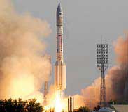 space program. According to the Central Research Institute for Machine Building, the Glonass system currently consists of 16 satellites, with 13 satellites operating as intended, two undergoing maintenance and one that is due to be withdrawn from the orbital grouping. A total of 9.9 billion rubles ($418.25 million) was allocated for Glonass from the federal budget in 2007, and 4.7 billion rubles ($200 million) in 2006. http://en.rian.ru/ space program. According to the Central Research Institute for Machine Building, the Glonass system currently consists of 16 satellites, with 13 satellites operating as intended, two undergoing maintenance and one that is due to be withdrawn from the orbital grouping. A total of 9.9 billion rubles ($418.25 million) was allocated for Glonass from the federal budget in 2007, and 4.7 billion rubles ($200 million) in 2006. http://en.rian.ru/ |
|
|
Indian Railway stations to use GPSbased digital clocks
Indian Railways will install GPS-based digital clocks at all railway stations across the country for uniformity in timing. Apart from synchronising the time up to the second, the time-piece will have the same size and design all over the country, a senior Railways Ministry official said. Railways has recently successfully completed trials of the GPS-based rolling stock tracking system called SIMRAN (Satellite Imaging for Rail Navigation). It is now planning to provide SIMRAN system on all the trains which will completely revolutionise the information dissemination system of Indian Railways. At present, railways is using the GPS for tracking trains for its location, speed, and direction of movement. http://www.zeenews.com |
|
|
Hi-tech PCR with geospatial techniques in New Delhi
A hi-tech Central Police Control Room to be inaugurated at the Delhi Police headquarters at ITO. With over 500 PCR vans fitted with the latest GPS, GIS and an online city map installed in the CPCR to track the movement of these vehicles, senior cops are expecting that their fight against terrorism and the overall policing standard will get a major boost.
Devised by HCL Technologies, the system will function on a call centre module. It will improve the response time by 10 minutes to 30 minutes. The Delhi Police also plans to install GPS and GIS system in the official vehicles of SHOs, ACPs and DCPs. http://timesofindia.indiatimes.com/ |
|
|
GPS helps beat fuel rises
SAT-NAV MAKER TOMTOM has unveiled its new Go x40 Live series with the first of three models which promise to help drivers stem rising fuel costs by providing information on the cheapest petrol stations on the route. The new devices promises better dynamic navigation by combining up-to-the minute traffic information and historical travel time information for every road, specified for every day of the week, at five minute intervals. The High Definition Traffic will be available for the first time in the UK, Germany, France, Switzerland and the Netherlands. http://www.theinquirer.net/ |
|
|
|
|
|
|
|
|
|
|


 (No Ratings Yet)


