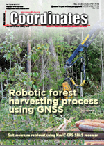
 FORESTRY
 Robotic forest harvesting process using GNSS satellite positioning data
Anna Klamerus Iwan, Louis-Francois Pau, Mariusz Kormanek, Janusz Golab and Krzysztof Owsiak
In this paper we contribute experimental findings to the issue of the accuracy of GNSS location measurements in forest environments, by addressing the effects of harvester trajectory errors due to GNSS measurements... [more]
 GNSS
GNSS
Radhika A Chipade
The present work reports the very first attempt of utilising indigenously developed NavICGPS- SBAS (NGS) user receiver to retrieve volumetric (surface) soil moisture (VSM). R2 values of 0.78 to 0.94 were observed between estimated soil moisture and in-situ data... [more]
Dinesh Manandhar
GNSS signals are quite vulnerable to interference, jamming and spoofing. Interference and jamming can be either intentional or non- intentional. But, Spoofing is an intentional act and the most serious one... [more]
 UAV
UAV Faiz Arif, Abdul Aziz Ab Rahman And Khairul Nizam Abdul Maulud
The research shows that UAV is applicable in monitoring changes along the coastal region which can be useful to assist the authority in deciding on enforcing nature conservation strategy to the affected site... [more]
 HIS COORDINATES
 Bring speed and accuracy in one easy-to-use GNSS solution - i50 GNSS RTK
High Accuracy Field Mobility by Arrow Series!
Complete Desktop Survey CAD Solution - Microsurvey CAD 2019
SF-5050 INTEGRATED STARFIRE™/RTK GNSS RECEIVER by NavCom
3D laser scanning mobile-device app wins IF DESIGN Award
Trimble TDC150 handheld maximizes productivity for mobile workers
CHC Navigation launches P3 GNSS sensor series
Septentrio GPS/GNSS helps cars avoid collisions on a smart highway
Russian company plans to create a federal Internet of things network
Singapore Police uses drone equipped surveillance vehicles
Hemisphere GNSS announces Multi-GNSS Vector™ V200 GNSS Compass
SatGen signal simulation software can now be used to simulate all major constellations and signals
'Add performance to your Mobile Mapping Solution'
Another Beidou navigation satellite successfully launched
ESCAPE project launches positioning module for autonomous driving
Capgemini and Autodesk partnership agreement
Esri acquires controlling stake from NIIT Technologies Limited in Esri India
SBG Systems introduces Quanta UAV,a New Line of INS/GNSS Systems
Solar 360 thermal drone solution by senseFly
Fortem Technologies and Unifly collaborate to keep airspace safe
Europe's first hydrogen drone doubles flight time
NextCore release new RN Series UAV LiDAR scanner
Centre for drone development soon at IIT Hyderabad


