 GEODESY
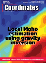
 Local Moho estimation using gravity inversion
Dr H M I Prasanna
Gravity inversion is a useful tool for determining Moho depths in regions without having adequate seismic information. The determination of Moho surface is important in various geophysical studies, such as studies of crustal and lithosphere signature and flexure studies.... [more]
 HYDROGRAPHIC SURVEY
Evaluation of KSACORSbased network GNSS-INS integrated system for Saudi coastal hydrographic surveys
Mohammed El-Diasty
This paper evaluated a real-time KSACORS-based NRTK GNSS-INS integrated solution and a post-processed KSACORS-based NPPK GNSS-INS integrated solution and then investigated whether these methods can meet the international standards (IHO standards) for hydrographic surveys performed by multibeam echosounder.... [more]
 REMOTE SENSING
Mapping the urban atmospheric carbon stock
MD Abdul Mueed Choudhury,Ernesto Marcheggiani,Andrea Galli,Giuseppe Modica And Ben Somers
Readers may recall that we have published the first part of this paper in April 2022 (Hyperlink the page - first part in April issue) issue of Coordinates where material and methods were discussed. Here we present the concluding part .... [more]
 MAPPING
Is India's forest cover really increasing? Official maps don't tell you the whole truth
M D Madhusudan and T R Shankar Raman
No, India's forest cover has not increased steadily. Instead, tea estates, coconut plantations, and even tree-lined avenues are being classified as forests. In one stroke, just between the 1999 and the 2001, this redefinition helped raise India's forest cover by over 38,000 sq.km., the size of Kerala. .... [more]
Hexagon helps electricity Company of Ghana
Tracking one million vehicles by 2025
Trimble and Infotech expand collaboration
GatesAir to introduces timing and signal reference generator
Interface between Vexcel's AMC and IGI's AEROcontrol GNSS/IMU systems introduced
Precision GNSS testing for any field of Smart Agriculture and Farming
First high-orbit GLONASS satellite in 2028
Protecting third-party timing receivers from cyber attacks
i83 IMU-RTK GNSS receiver by CHC navigation
Flight trials by AAI using GAGAN based LPV approach procedure
Kraken completes RaaS contract from Government of Canada
Showing new light for global warming challenge
Advance autonomous vehicle scaled production program
Isuzu Australia drives forward with HERE
Baidu wins first driverless permits in China
Driver-assistance technology for collision avoidance
World's largest autonomous commercial drone deployment
Interim approval to 'Kisan Drones' in India
Pixxel launches first commercial satellite
New technology for mapping and analyzing space debris by Fujitsu
Planet forms strategic relationship with Moody’s
3D LiDAR and deep vision data platforms integration
China launches remote sensing on crops


