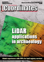
 LIDAR
LIDAR Territorial and topographic analysis for the protection and enhancement of fragile archaeological areas
A Garzulino, M Marzullo
The carried out activities were aimed at defining the best methodologies for the documentation, analysis, protection and enhancement of the archaeological remains in the territory of Tarquinia. Given the complex morphology of the area, the ancient emergencies spread over fourteen centuries and the dense vegetation characterizing the slopes, a laser scanner survey using LiDAR technology of the entire area was performed in order to investigate the archaeological objects... [more]
 CADASTRE
 The Northern Territory - Digital survey and cadastral innovators
Ian Harper
The processes identified in this paper can relate to any jurisdiction in the world that is looking to digitally manage and upgrade cadastral data. The NT cadastre is measurement based (bearing and distances) but the processes implemented by the NT are equally applicable to a coordinate based cadastre... [more]
 LAND ADMINISTRATION
 Global experiences with public private partnerships for land registry services: A critical review
Dr. Keith Clifford Bell
The purpose of this paper is to provide an overview of experiences globally with LRS PPPs and privatization proposals. Readers may recall that we published the first part of the three parts of the paper in the last issue where emphasis was on understanding privatization and Public Private Partnerships. Here we present the second part of the paper. In this section, author shares some of the global experiences from Canada, United Kingdom and Malaysia... [more]
'Add performance to your Mobile Mapping Solution'
Where Have You Been With Your TRIUMPH-LS Lately
Racelogic announce new indoor positioning system
Verified Photomontages for UNESCO world heritage sites achieves best accuracy
Leica Geosystems announces Leica Zeno mobile
Second generation dual frequency GNSS by Broadcom
NovAtel SMART7 antenna
CHC navigation introduces LT700H GNSS RTK tablet
RIEGL strengthens construction and surveying market presence
FAA announces LAANC expansion to major airports, adds new providers
UK Civil Aviation Authority launches platform to recover lost drones
Trimble launches UAS1 highprecision GNSS board
Drone delivers laboratory supplies in 43-mile ocean-crossing test


