 INTERVIEW
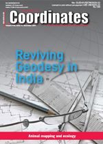
 "We are trying to revive Geodesy in India"
Maj Gen (Dr) B.Nagarajan
Unlike rest of the countries in the world, for some inexplicable reasons, the science of Geodesy was treated as restricted and was taught and practiced only in Survey of India in our country, though this subject is the mother of all geosciences... [more]
 DISASTER MANAGEMENT
Satellite based assessment of the damage caused by Tauktae cyclone in Gir protected area
Dr C P Singh,C Patnaik,A Das,Dr M R Pandya And Dr B K Bhattacharya
Cyclone 'Tauktae' hit the Gujarat coast, India on May 17, 2021, which affected the Gir National Park, a wildlife sanctuary for Asiatic lions. In order to do a quick assessment of the affected area, a suite of optical and microwave satellite datasets were analysed for pre and post cyclone periods ... [more]
 LAND ADMINISTRATION
Spatial dependencies inland use and irrigation access in Northern Peru
Eduardo Zegarra
In this study spatial models are estimated for irrigated land in Northern Andes of Peru considering geographic, climate and socio-economic factors. Most geographic variables show significant coefficients an d expected signs.... [more]
 HUMOROUS SCIENCE
Humorous science: Animal mapping and ecology
Volker Janssen
This paper highlights amusing research related to the animal kingdom, improving our understanding of animal behaviour, ecology and conservation, often by employing spatial tools and innovative approaches to data collection and analysis.... [more]
Hexagon Power Portfolio 2022
Orolia signs an agreement to acquire Seven Solutions
Trimble releases turnkey autonomous robotic scanning solution
World's highest-performing radio occultation satellite
Virtual 3D model baseline survey for GoviEx Uranium
ModalAI releases new Seeker micro-development drone
Electric robots are mapping the seafloor
Drones to map 700 villages in Assam
Galileo satellites arrive at Europe's Spaceport
No foreign components in Glonass satellites
Ginan: Analysis Centre Software
Michibiki-1R navigation satellite launched by Japan
Test capability for Galileo HAS By Spirent
GLONASS ground station in India by 2022
Improving safety and reliability of Metro Rail Services in Singapore
Lucknow, India to roll out GIS mapping system
Call for governments to recognize value of location in climate change action
OceanProtect Data Protection Solution
ESA and NASA launch revolutionary open-source platform


