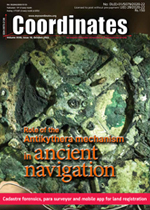
Cadastre forensics, para surveyor and mobile app for land registration Trias Aditya | The Antikythera Mechanism: Discerning its role in ancient navigation James E.(Jim) Wyse | Integrated UAV photogrammetry and automatic feature extraction for cadastral mapping Oluibukun Gbenga Ajayi and Emmanuel Oruma | Interview Kiyokazu minami and Takeyasu Sakai
 NAVIGATION
 The Antikythera mechanism: Discerning its role in ancient navigation
James E. (Jim) Wyse
Many researchers and writers proffer that the Antikythera Mechanism served no substantive navigational purpose. This paper challenges that assertion and delineates an important potential role for the Mechanism in a navigational process practiced by mariners in the 18th and 19th centuries ... [more]
 CADASTRE
Cadastre forensics, para surveyor and mobile app for land registration
Trias Aditya
The latest trend in the utilization of mobile technology as a field data collector for land-related data collections and lessons learnt from other countries on how innovations can reform land administration have motivated local land offices and project executors to use a mobile application to collect land boundaries and their associated formal data for land registration purposes. ... [more]
 INTERVIEW
"In Japan, navigation technology is now mainly based on satellite positioning technology, which is now widely used for land and sea operations"
says Kiyokazu Minami and Takeyasu Sakai Kiyokazu Minami and Takeyasu Sakai of Japan Institute of Navigation
 UAV
UAVIntegrated UAV photogrammetry and automatic feature extraction for cadastral mapping
Oluibukun Gbenga Ajayi and Emmanuel Oruma
The principal objective of this research is to investigate the applicability of UAV photogrammetry integrated with automatic feature extraction for cadastral mapping. We present first part of the paper in this issue. The concluding part will be published in the next issue ... [more]
Ultracam Eagle 4.1 - Going the extra mile so you can too!
Resilient GNSS solution for the Future Flight Challenge Phase 3
Visual Navigation System for GNSS-denied environments
New Trimble TerraFlex Software Edition
Collaborate on 6G JCAS research and early validation
Topcon launches GNSS network correction service in Finland
Improving signal gain for automotive GNSS antennas
Pentagon warns of GPS interference from Ligado broadband network
Latest Galileo satellites join constellation with enhanced, faster fix
Galileo Second Generation technology tested in ESA labs
ESA testing sensor network for smart city navigation
Dr Boris Pervan receives Kepler award
Orolia redefines GNSS simulation with GSG-7 simulator
UNESCO Shipwreck Mission in Mediterranean Successfully Completed
Unlocking agricultural field data at global scale
Improving emergency response with 3D mapping
Vodafone developing technology for autonomous vehicles
Automakers in China must have licence for mapping data in smart cars
5G network without GNSS timing
Nokia introduces new SaaS service
Planet Partners with Taylor Geospatial Institute
SOSLAB launches Nextgeneration 3D Solid-state LiDAR
New Leica DMC-4 airborne imaging sensor


