| |
 |
|
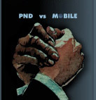
PND vs mobile – Is landscape shifting?
Tomas Miranda, Gary Gale, Roger Jollis, Caroline Chow, Dominique Bonte, André Malm, Rohan Verma
With the growth of mobile phone and smart phone users and application built upon it, PNDs are set to face a tough challenge from GPS-enabled mobile phones. While Google and Apple are set to redefine the navigation ambience, with terms like Mobile Internet Devices (MID) getting clearer definitions, it is still too early to say which direction the navigation markets will move in [more] |
|
|
|
|
| |
 |
|
| |
| |
| |
|
|
|
|
|
| |
 |
|
| |
Precise Orbit Determination of a Galileo/GIOVE-A Satellite
Hua Su and Bernd Zimmermann
This paper presents, a new approach to form double differences of carrier-phase measurements between a GIOVE-A satellite and GPS satellites. To form such differences, the GIOVE satellite measurements shall be synchronized with the GPS time reference. [more] |
|
| |
|
|
| |
 |
|
Date : 8th July
Time : 10.00 am IST, 12.30 pm MYT, 2.30 pm AEST
Join Bentley and Terrasolid to see 3D City GIS modeling and management technologies that improve the accuracy and usefulness of municipal GIS |
|
|
|
|
|
|
| |
|
|
| |
|
|
|
| |
|
|