March 2009
Mycoordinates.org

Harbour Navigation  Charles S Dixon |  Real time-monitoring of Dalian Beida Bridge  Wang Jun, Yi Xiaodong and Wei Erhu In the line of sight Shubhra Kingdang  | Offshore application of EGNOS Steve Leighton  | Interview Jason Hamilton


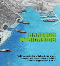
Harbour navigation
Charles S Dixon
GPS performance today is suitable for the Oceanic Navigation Phase; for the other Phases, however, GPS cannot reliably meet requirements for accuracy or integrity. In many Ports, various objects including high buildings, gantry and other cranes, and bridges, may obstruct the sky view for user vessels, potentially blocking GPS satellite signal reception.
[more]

Real time monitoring of Dalian Beida bridge
Wang Jun, Yi Xiaodong and Wei Erhu
With the GPS receiver, it is easy to monitor the bridge of three dimensional dynamic deformation in real-time as well as first step bridge vibration mode frequency or higher step one which can provide the datum.
[more]

In the line of sight- A perspective of surveying equipment industry in India
Shubhra Kingdang
The growth in the survey industry has been fuelled by the spate of infrastructure projects in the country and may well ride out the economic slowdown wave without feeling the pinch.
[more]

Offshore application of EGNOS
Steve Leighton
The GIANT project has been pushing ahead with the necessary activities to make EGNOS a viable navigation system in the hazardous North Sea environment
[more]


Industry news
 
Galileo update
 
Other news

News from Leica

Hemisphere GPS and partners sponsor Green Miles project

GIS data collection to GPS handheld by Topcon

Bentley’s “Be Employable” initiative

News from Trimble

Magellan and Carlson software partnership

EUROCONTROL contract with GMV


Infrastructure modeling software by Autodesk

Infotech and VolkerWessels Telecom agreement

SuperGIS Server Beta releasing in March

Groupe Alta and IMT partnership


GRACE hosts UK “Growing Galileo” event

The GNSS Research and Applications Centre of Excellence (GRACE) based at University of Nottingham hosted the UK ‘Growing Galileo’ event
[more]

Galileo gets military clearance

The European Parliament has opened the way for the civilian Galileo satellite system to be used for military and security purposes as part of a plan to improve the efficiency of defence communication.[more]


Galileo commercial authorisation

Receiver technology having Galileo capability to operate in the Galileo frequency bands and using information from the Galileo system for future operational satellites is restricted [more] 


Intelligent map system tender by SLA

Cochin port ERP project completed by TCS India

Australian bushfires spark Open Data debate

Rediff.com adds maps feature to LocalAds

Iridium 33 and Cosmos 2251 satellite collision

DigitalGlobe announces agreement with Nokia

Third Satellite of GLONASS is active

Navteq selected for Arc-Logistics Navigator solution

Map mistake: three officials suspended in India

Osama hunt: can UCLA trump CIA?

Chinas 3rd ocean survey satellite in 2010


© Centre for Geoinformation Technologies, 2008