Articles in the News Archives Category
M-code compatible navigation system by Collins Aerospace
Collins Aerospace has introduced NavHub™-200M, the first non-ITAR vehicular navigation system for the international market compatible with Military Code (M-Code) receiver technology.It provides Assured Positioning, Navigation and Timing (APNT) capabilities while improving overall resistance to existing and emerging threats to GPS, such as jamming and spoofing. www.collinsaerospace.com
Small SWaP Time-space …
Dubai completes hydrographic data survey of all marine areas
Dubai Municipality has announced the completion of a first-of-its-kind hydrographic survey of the territorial waters of the Emirate, conducted to generate comprehensive marine data in accordance with the specifications of the International Hydrographic Organization (IHO). The survey is part of the Municipality’s efforts to support the …
UK satellite navigation signal generated
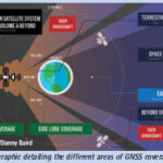
An Inmarsat-led team of companies in the UK, building on national expertise and prior experience within the group, has begun broadcasting a satellite navigation signal as part of a programme to explore the creation of a sovereign national capability in resilient positioning, navigation and timing (PNT) for the aviation and …
New batch of RS satellites by China
China successfully launched three new remote sensing satellites from the Xichang Satellite Launch Center in southwest China’s Sichuan Province on June 23, 2022.
The satellites were launched as the second batch of the Yaogan-35 family at 10:22 a.m. (Beijing Time) by a Long March-2D carrier rocket and entered the planned …
Skyline Nav AI, Draper win contract
The project is led by Skyline Nav AI, which has secured a contract from the U.S. Air Force Research Laboratory (AFRL) to provide GPS-independent localization capability for the ATAK platform. Draper will integrate Skyline’s application into ATAK’s front-end. It is currently on contract with the U.S. Department of Defense …
Drone Festival – Bharat Drone Mahotsav 2022
Prime Minister Shri Narendra Modi inaugurated Drone Festival – Bharat Drone Mahotsav 2022 on May 27, 2022. He also interacted with Kisan drone pilots, witnessed open-air drone demonstrations and interacted with startups in the drone exhibition centre. Several union ministers, leaders and entrepreneurs of drone industry were among …
Enhanced operations in Australia by Satellogic
Satellogic Inc has announced that it is enhancing its operations in the Australian market to strengthen its regional customer relationships and provide local support for a growing APAC space economy. It currently operates 22 high-resolution satellites and expects to grow its constellation to 34 satellites by Q1 2023. By 2025, …
Chinese-made BeiDou satellite system output value hits new record
The output value of China’s BeiDou Navigation Satellite System (BDS) reached a new high of 469 billion yuan ($69 billion) in 2021, up 16.29 percent year on year, according to a white paper recently released.
The white paper, issued by the Global Navigation Satellite System …
Forest Survey of India says forest cover estimate is done with field data tallied with Satellitebased Interpretation
Amid criticism from experts of its methodology to map forest cover in the country, the Forest Survey of India (FSI) has said that the forest cover is estimated from the field inventory data, which corroborate the figures obtained from …
New Airborne LiDAR Series by CHC navigation
CHC Navigation have recently released the AlphaAir 140 and AlphaAir 2400 LiDAR systems. Both are very lightweight and compact airborne laser scanners that are easily installed on various UAV platforms or small survey aircraft and helicopters. They are ideally adapted to high-density point corridor mapping applications, day or …


 (5.00 out of 5)