Articles in the Navigation Category

From the early days of the development of basic navigational software built into satellite navigational receivers, it has been noted that for the sake of simplicity and a number of other reasons, this navigational software is often based on methods of limited accuracy [1]. It is surprising that even nowadays the use of navigational software is still used in a loose manner, sometimes ignoring basic principles and adopting oversimplified…

The Global Positioning System(GPS) (Brown and Hwang 1997; Farrell and Barth 1999; Gelb 1974) and inertial navigation system (INS) have complementary operational characteristics and the synergy of both systems has been widely explored. An integrated GPS/INS system is typically carried out through the extended Kalman filter (EKF). The EKF is the approximate nonlinear filters which linearizes the system…
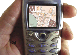
LBS appear to be one of the next natural steps in our move towards a truly unwired permanently connected society
The past decade has seen a quantum jump in mobile usage driven by two factors – one on the basic premise that almost everyone talks and walks and secondly, the underlying technology that has enabled this …

Because of the MEMS inertial sensors being more and cheaper, most studies focus on their applications. It is known that the simple principle and construction of the MEMS accelerometer make it is possible to improve the performance of MEMS accelerometers faster than that of gyros, so most efforts are done to use only the linear accelerometers forming the IMU called IMU-BA which has the potential market in the land and air navigation system, such as the car…

The effort for realizing fully autonomous and operative Unmanned Aerial Systems (UAS) induced the need of developing innovative techniques for integrating measurements derived from different aircraft navigation systems. Since no human aid is available onboard UAVs, navigation hardware must attain larger capabilities than the ones of manned platforms. In particular, the most important features that shall be considered are autonomy, safety,…

Certain emerging navigation performance requirements for maritime applications are challenging to satisfy using systems available today. Very stringent performance requirements have, in particular, been identified for port areas, and cover aspects including service robustness, accuracy, integrity and availability…

At SatNav, we have had the privilege of seeing the Indian GPS Navigation Industry from the year 2002, the time we launched our first voice based system, when comments like ‘who needs it?’, ‘my driver knows all the places’, ‘I prefer asking a panwallah to such devices’were the norm. Today the world has changed where the comments are, ‘why doesn’t it tell me the right way to my home?’ and ‘it’s a useful product’, ‘we appreciate…

The current GPS civil service provides suitable performance only in situations of good electromagnetic visibility; the positioning becomes difficult in severely signal degraded environments, e.g. mountainous or urban areas, where a lot of GPS signals are blocked by buildings or
natural obstacles. The GPS gaps can be partially solved employing spacebased augmentations systems; in this paper we consider geostationary and geosynchronous constellations. A simulation software has been developed in MATLAB® environment in order to study the integration of existent and feasible constellations.

As per the textbook theory of market maturity in any country, the expected stages are that of market development, rapid growth, saturation or maturity and the decline. Having had the good fortune to predict the evolution of GPS Navigation market in India, here is a retrospective of the various phases, from both the vendor’s and consumer perspective.

MSAS (MTSAT Satellite-based Augmentation System is the Japanese satellite based augmentation system which has been prepared by the Civil Aviation Bureau of Ministry of Land, Infrastructure, Transport and Tourism (MILT) and started on 27 September 2007, to serve for improving accuracy, integrity, and availability of GPS positioning on the civil aircrafts. It has two geostationary satellites, called MTSAT-1R and MTSAT-2 located at 140 and 145 degrees in the east longitude, on the orbit of 3600km above the Equator. The satellites were launched in February of 2005 and 2006 respectively, long after the launch failure on November 1999. MTSAT, which stands for Multi-functional Transport SATellite, also has a function of geostationary metrological satellite.


 (5.00 out of 5)